2024-07-02 17:30:03
1719956424
|
|
| Mesoscale Discussion 1512 | |
| < Previous MD | |

|
|
Mesoscale Discussion 1512
NWS Storm Prediction Center Norman OK
0354 PM CDT Tue Jul 02 2024
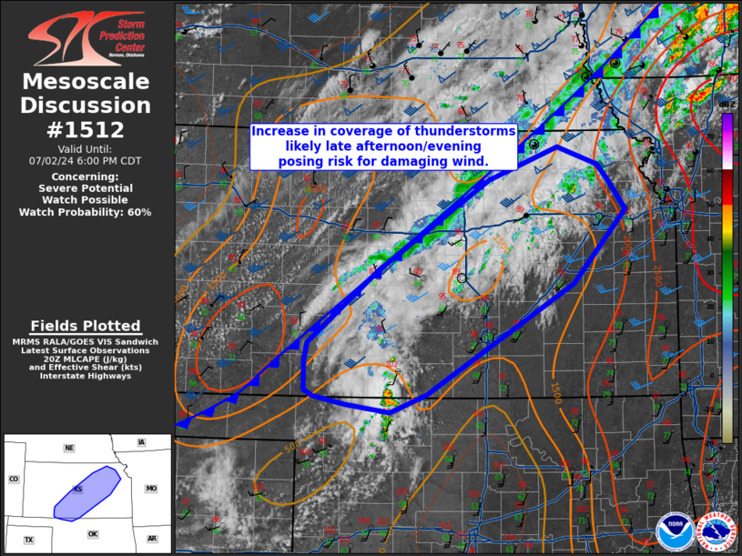
Areas affected...far northern Oklahoma...portions of
south-central/central and northeastern Kansas
Concerning...Severe potential...Watch possible
Valid 022054Z - 022300Z
Probability of Watch Issuance...60 percent
SUMMARY...Increasing coverage of thunderstorm activity is expected
to continue through the late afternoon/evening, posing a risk for
mainly damaging wind.
DISCUSSION...A southeastward moving cold front will be the focus for
additional thunderstorm development across far northern Oklahoma
into central and northeastern Kansas this afternoon. Daytime heating
has led to temperatures in the upper 90s to low 100s across much of
this region, with dew points in the upper 60s to 70s and MLCAPE
around 1000-2000 J/kg in mesoanalysis. Given the best shear is
largely north of the cold front, mode is expected to be loosely
organized clusters. Steep low-level lapse rates and deeply mixed
profiles will support a risk for mainly damaging winds. A watch may
be needed for part of this region to cover this threat in the next
1-2 hours.
..Thornton/Gleason.. 07/02/2024
...Please see www.spc.noaa.gov for graphic product...
ATTN...WFO...EAX...TOP...ICT...OUN...DDC...
LAT...LON 37609986 38429886 39459728 39819629 39629573 39469559
39119533 38279608 37039817 36839869 36929932 37009977
37079991 37409990 37609986
|
|
|
Top/All Mesoscale Discussions/Forecast Products/Home |
|