2024-07-02 00:05:03
1719893838
|
|
| Mesoscale Discussion 1510 | |
| < Previous MD | |

|
|
   Mesoscale Discussion 1510
   NWS Storm Prediction Center Norman OK
   1103 PM CDT Mon Jul 01 2024

   Areas affected...southeast NE

   Concerning...Severe potential...Watch unlikely

   Valid 020403Z - 020530Z

   Probability of Watch Issuance...20 percent

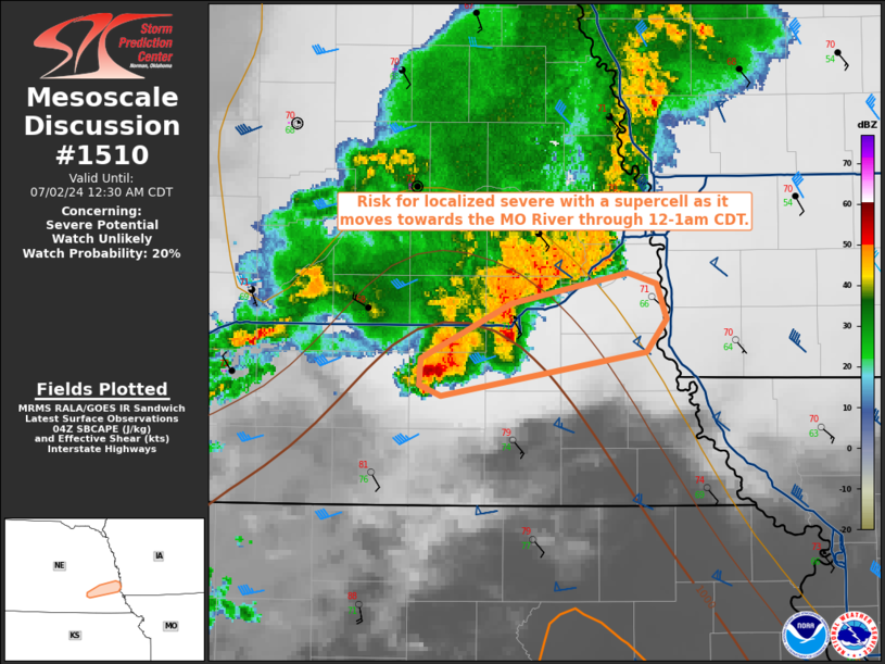
   SUMMARY...Risk for localized severe with a supercell as it moves
   towards the MO River through 12-1am CDT.

   DISCUSSION...A couple of stronger updrafts over the past hour have
   developed on the southern flank of a band of storms over eastern NE.
   Surface conditions with temperatures in the upper 70s with lower 70s
   dewpoints in Gage County (immediate inflow) will become less
   supportive near the MO River with temperatures likely holding in the
   lower 70s with mid-upper 60s dewpoints.  The latest RAP forecast
   soundings show around 2000 J/kg SBCAPE near Beatrice with
   surface-based buoyancy below 250 J/kg SBCAPE near the MO River.  As
   such, expecting the peak in storm intensity to have occurred or to
   occur in the immediate short term before storm intensity lessens
   with time.

   ..Smith.. 07/02/2024

   ...Please see www.spc.noaa.gov for graphic product...

   ATTN...WFO...OAX...

   LAT...LON   40679730 40919676 41059606 41019588 40859582 40699595
               40509718 40559731 40679730
|
|
|
Top/All Mesoscale Discussions/Forecast Products/Home |
|


