2024-06-30 18:05:02
1719785361
|
|
| Mesoscale Discussion 1498 | |
| < Previous MD | |

|
|
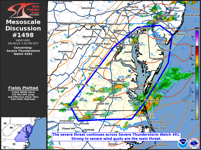
Mesoscale Discussion 1498 NWS Storm Prediction Center Norman OK 0503 PM CDT Sun Jun 30 2024 Areas affected...portion of eastern Maryland and Virginia into Delaware Concerning...Severe Thunderstorm Watch 491... Valid 302203Z - 302330Z The severe weather threat for Severe Thunderstorm Watch 491 continues. SUMMARY...The severe threat continues across Severe Thunderstorm Watch 491. Strong to severe wind gusts (50-65 mph) remain the primary threat with the stronger storms, though an instance of marginally severe (around 1 inch diameter) hail is also possible. DISCUSSION...Multicells and occasional transient supercells are in progress across eastern MD into DE and eastern VA, which have shown signs of intensification over the past couple of hours per latest MRMS mosaic radar data. Though deep-layer shear is not as strong as farther north (i.e. around 35 kts or so of bulk effective shear), this amount of shear is more than adequate given 2500+ J/kg MLCAPE in place. Regional radar data suggests these storms may be producing wet downbursts, so strong to severe gusts remain possible through the remainder of the afternoon, in additional to an instance or two of marginally severe hail. ..Squitieri.. 06/30/2024 ...Please see www.spc.noaa.gov for graphic product... ATTN...WFO...PHI...AKQ...LWX...RAH...RNK... LAT...LON 36717934 38897732 39597624 39657519 39307463 38277485 37567537 36807598 36237654 36217772 36157892 36717934 |
|
|
Top/All Mesoscale Discussions/Forecast Products/Home |
|


