| Mesoscale Discussion 1497 | |
| < Previous MD | |

|
|
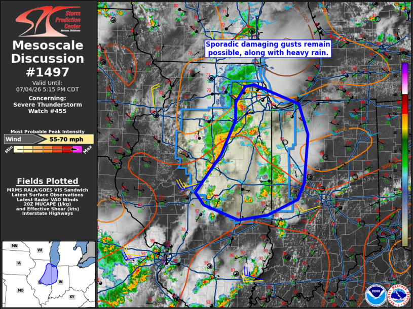
Mesoscale Discussion 1497 NWS Storm Prediction Center Norman OK 0351 PM CDT Sat Jul 04 2026 Areas affected...northeast Illinois into western Indiana Concerning...Severe Thunderstorm Watch 455... Valid 042051Z - 042215Z The severe weather threat for Severe Thunderstorm Watch 455 continues. SUMMARY...Locally damaging wind gusts remain possible from east-central Illinois into western Indiana. A new watch may not be needed depending on trends. DISCUSSION...Convection increased ahead of the MCV moving out of IA, but has generally moved slowly, producing heavy rain. The air mass across the region continues to heat and destabilize, and remains sufficient for at least localized severe wind gusts. Recent radar trends have shown some bowing storms, which may be capable of damaging gusts. Unless storms become better organized, an additional watch may not be needed downstream. ..Jewell.. 07/04/2026 ...Please see www.spc.noaa.gov for graphic product... ATTN...WFO...IWX...IND...LOT...ILX... LAT...LON 39958946 40708881 41388845 41738846 42038821 42078797 41698681 41108659 40168670 39828687 39528762 39428837 39718924 39958946 MOST PROBABLE PEAK WIND GUST...55-70 MPH |
|
|
Top/All Mesoscale Discussions/Forecast Products/Home |
|
Source link