2024-06-30 15:24:03
1719775636
|
|
| Mesoscale Discussion 1493 | |
| < Previous MD | |

|
|
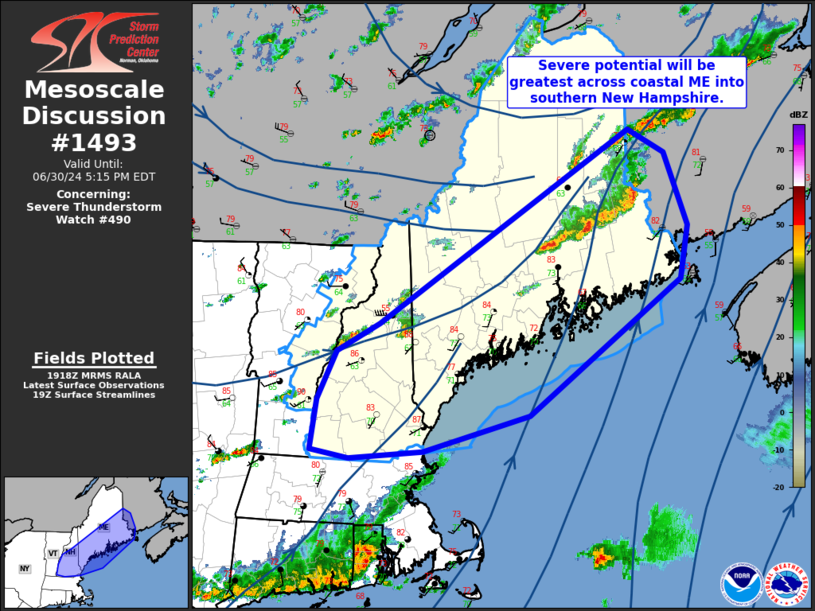
Mesoscale Discussion 1493 NWS Storm Prediction Center Norman OK 0221 PM CDT Sun Jun 30 2024 Areas affected...portions of Maine into New Hampshire Concerning...Severe Thunderstorm Watch 490... Valid 301921Z - 302115Z The severe weather threat for Severe Thunderstorm Watch 490 continues. SUMMARY...Severe thunderstorms producing strong/damaging gusts remain possible across southern New Hampshire into coastal and Down East Maine. DISCUSSION...The strongest convection ongoing this afternoon is along a pre-frontal surface trough and within the axis of greater instability and low-level moisture. A line of strong to severe storms producing wind damaging will continue to shift east/southeast across Down East Maine the next couple of hours. Additional more isolated convection is ongoing across New Hampshire and will shift into coastal Maine, also posing a damaging wind risk. Additional storms may move into northern Maine in association with the synoptic cold front. However, cooler temperatures and lower dewpoints are resulting in weaker instability with northward extent, and severe potential will be a bit lower compared to further south. ..Leitman.. 06/30/2024 ...Please see www.spc.noaa.gov for graphic product... ATTN...WFO...CAR...GYX...BOX...ALY... LAT...LON 44187148 46256775 46016720 45236687 44656698 43206925 42817082 42737191 42817247 43357238 43887210 44187148 |
|
|
Top/All Mesoscale Discussions/Forecast Products/Home |
|


