|
|
| Mesoscale Discussion 1459 | |
| < Previous MD | |

|
|
   Mesoscale Discussion 1459
   NWS Storm Prediction Center Norman OK
   1046 PM CDT Thu Jun 27 2024

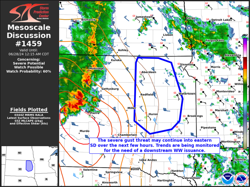
   Areas affected...portions of eastern South Dakota

   Concerning...Severe potential...Watch possible

   Valid 280346Z - 280515Z

   Probability of Watch Issuance...60 percent

   SUMMARY...At least a few severe gusts could occur in eastern SD,
   east of ongoing Severe Thunderstorm Watch 478. An additional
   downstream Severe Thunderstorm Watch may be needed pending favorable
   convective trends and high enough confidence in continued severe
   gusts.

   DISCUSSION...The southern portions of a mature MCS continue to
   rapidly progress eastward, with echo tops exceeding 50 kft at times.
   The southern portion of this MCS remains well organized, and
   continues to produce measured severe gusts (per recent surface
   observations). Though MLCINH continues to increase, 03Z mesoanalysis
   also shows 3000 J/kg MLCAPE immediately to the south of the ongoing
   MCS, which is likely supporting continued severe potential. Surface
   temperatures and MLCAPE do decrease with eastern extent into eastern
   SD, so it is unclear if/how much of the severe gust threat will
   extend past the bounds of Severe Thunderstorm Watch 478. As such,
   convective intensity and wind report trends will continue to be
   monitored for the need of a WW issuance over the next few hours.

   ..Squitieri/Smith.. 06/28/2024

   ...Please see www.spc.noaa.gov for graphic product...

   ATTN...WFO...FSD...ABR...

   LAT...LON   43899814 44249870 45399867 45779867 45909859 45899782
               45779734 44819694 44239706 44029734 43899814
|
|
|
Top/All Mesoscale Discussions/Forecast Products/Home |
|


