|
|
| Mesoscale Discussion 1451 | |
| < Previous MD | |

|
|
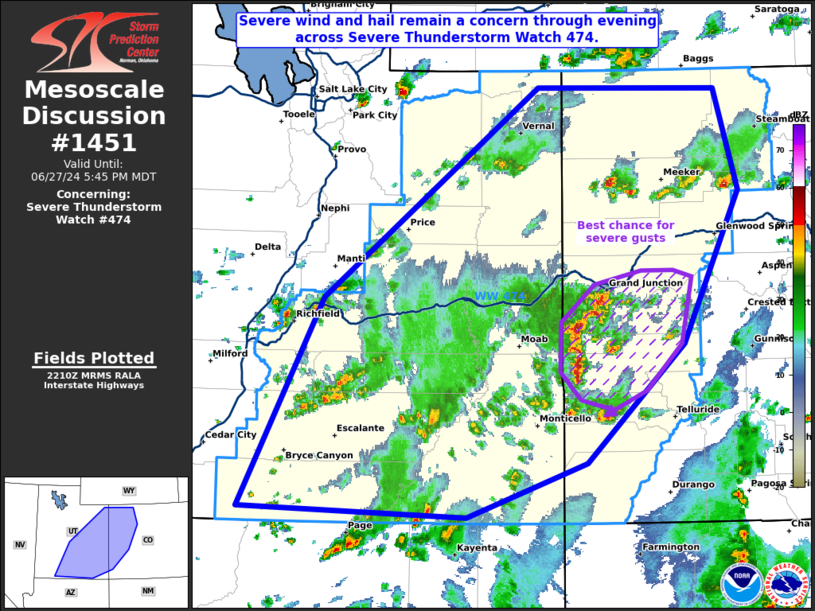
Mesoscale Discussion 1451 NWS Storm Prediction Center Norman OK 0512 PM CDT Thu Jun 27 2024 Areas affected...Portions of eastern Utah into western Colorado Concerning...Severe Thunderstorm Watch 474... Valid 272212Z - 272345Z The severe weather threat for Severe Thunderstorm Watch 474 continues. SUMMARY...The severe threat continues across Severe Thunderstorm Watch 474. Severe wind and hail remain the primary concerns through the rest of the evening. DISCUSSION...Scattered multicells and transient supercells persist across portions of UT into western CO, some of which have a history of severe hail and occasional strong wind gusts. 500-1000 J/kg MLCAPE remains across portions of the Interior West, which will support continued severe wind/hail potential through at least sunset. Severe gusts are more likely across Mesa into Montrose Counties in CO, where some congealing of multicells has recently occurred. ..Squitieri.. 06/27/2024 ...Please see www.spc.noaa.gov for graphic product... ATTN...WFO...GJT...SLC... LAT...LON 37121267 38981174 40850932 40830729 39920703 38570768 37520878 37041013 37121267 |
|
|
Top/All Mesoscale Discussions/Forecast Products/Home |
|