|
|
| Mesoscale Discussion 1448 | |
| < Previous MD | |

|
|
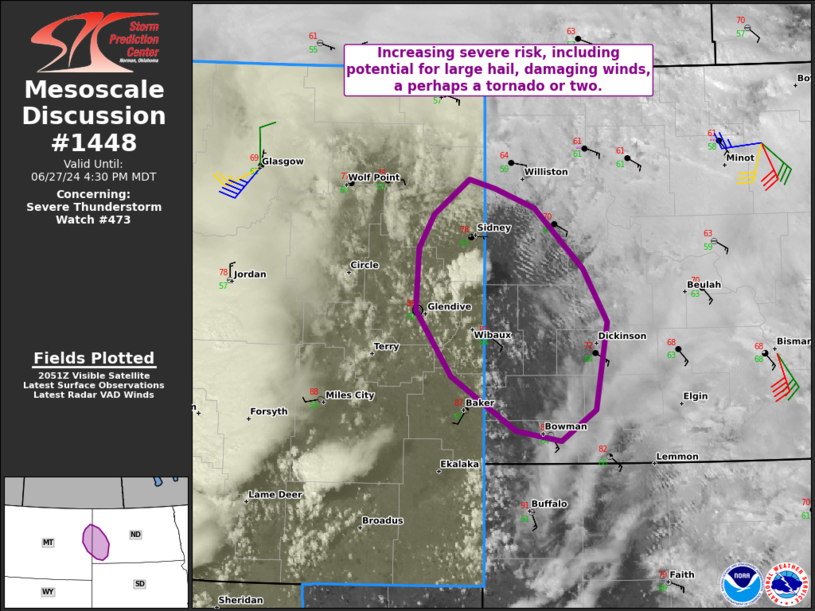
Mesoscale Discussion 1448 NWS Storm Prediction Center Norman OK 0357 PM CDT Thu Jun 27 2024 Areas affected...Portions of far eastern Montana and western North Dakota Concerning...Severe Thunderstorm Watch 473... Valid 272057Z - 272230Z The severe weather threat for Severe Thunderstorm Watch 473 continues. SUMMARY...Severe risk is increasing across far eastern Montana into western ND, including the potential for large hail, damaging winds, and perhaps a tornado or two. DISCUSSION...Cumulus is deepening along an effective warm front extending east-southeastward from eastern MT into western ND, and isolated convective initiation is underway over Wibaux County MT. Regional VWP shows ample low-level hodograph curvature associated with backed surface winds beneath a plume of strong low-level warm-air advection. Additionally, diurnal heating along the boundary has yielded moderate surface-based instability. These factors, along with around 50 kt of effective shear, could support a couple semi-discrete supercells. Large hail and damaging winds are the main concern, though the favorable low-level hodograph curvature could support a tornado threat as well. A watch will eventually be needed into western North Dakota for the above-mentioned severe risk and for severe storms tracking eastward out of eastern Montana. ..Weinman/Hart.. 06/27/2024 ...Please see www.spc.noaa.gov for graphic product... ATTN...WFO...BIS...BYZ...GGW... LAT...LON 46200368 46610441 47130482 47600479 47860461 48130421 48070393 47910348 47450292 47040265 46360279 46120317 46200368 |
|
|
Top/All Mesoscale Discussions/Forecast Products/Home |
|


