|
|
| Mesoscale Discussion 1420 | |
| < Previous MD | |

|
|
   Mesoscale Discussion 1420
   NWS Storm Prediction Center Norman OK
   1113 PM CDT Tue Jun 25 2024

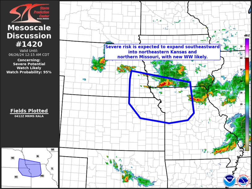
   Areas affected...southeastern Nebraska...northeastern
   Kansas...southwestern Iowa...and northwestern Missouri

   Concerning...Severe potential...Watch likely

   Valid 260413Z - 260515Z

   Probability of Watch Issuance...95 percent

   SUMMARY...Scattered strong/severe storms over portions of Nebraska
   and southern Iowa should expand southeastward and increase in
   coverage over the next few hours.  New WW -- extending into
   northeastern Kansas and northwestern Missouri, will be needed
   shortly.

   DISCUSSION...Latest radar loop shows clusters of strong/severe
   storms from north-central Nebraska to southwestern Iowa, moving
   steadily southeastward.  With a moderately unstable airmass (3000 to
   3500 J/kg mixed-layer CAPE per RAP-based objective analysis) ahead
   of the convection into Kansas/Missouri, and a moderate southwesterly
   low-level jet observed, continued southeasterly advance of the
   convection is expected.  With this area beneath the
   leading/expanding edge of stronger mid-level northwesterly flow,
   storms should organize/grow upscale with time, propagating southward
   with attendant risks for large hail and damaging winds.  The
   anticipated/expanding risk will warrant new WW issuance shortly.

   ..Goss/Gleason.. 06/26/2024

   ...Please see www.spc.noaa.gov for graphic product...

   ATTN...WFO...DMX...EAX...OAX...TOP...

   LAT...LON   38559430 38839636 39669721 41009719 41499708 40849273
               39109251 38729296 38559430
|
|
|
Top/All Mesoscale Discussions/Forecast Products/Home |
|


