|
|
| Mesoscale Discussion 1417 | |
| < Previous MD | |

|
|
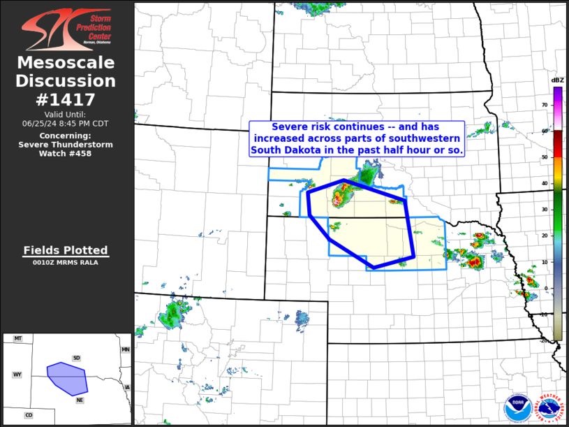
Mesoscale Discussion 1417 NWS Storm Prediction Center Norman OK 0713 PM CDT Tue Jun 25 2024 Areas affected...southwestern and south-central South Dakota and into north-central Nebraska Concerning...Severe Thunderstorm Watch 458... Valid 260013Z - 260145Z The severe weather threat for Severe Thunderstorm Watch 458 continues. SUMMARY...Risk for large hail and damaging winds continues locally, with greatest risk in the short term apparent over the southwestern South Dakota vicinity. DISCUSSION...Latest radar loop shows a storm moving southeastward out of Jackson County into Bennett County South Dakota at this time. This cell emerged from a cluster of weaker convection east of the Black Hills, but has intensified and organized rapidly over the past hour into a supercell with HP characteristics as it encounters an axis of greater boundary-layer moisture/mixed-layer CAPE. Along with potential for damaging wind gusts, large hail in excess of 2" in diameter is likely with this cell, as it moves southeastward at near 40 kt. Elsewhere, more isolated/potentially severe storms will likewise continue moving southeastward over the next 1 to 2 hours, with large hail and locally damaging winds possible in/near WW 458. ..Goss.. 06/26/2024 ...Please see www.spc.noaa.gov for graphic product... ATTN...WFO...FSD...LBF...UNR... LAT...LON 43590275 43890158 43409959 42059933 41800060 42470202 43050267 43590275 |
|
|
Top/All Mesoscale Discussions/Forecast Products/Home |
|


