|
|
| Mesoscale Discussion 1409 | |
| < Previous MD | |

|
|
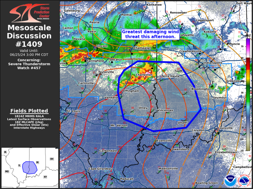
Mesoscale Discussion 1409 NWS Storm Prediction Center Norman OK 0126 PM CDT Tue Jun 25 2024 Areas affected...eastern Illinois and southwest Indiana Concerning...Severe Thunderstorm Watch 457... Valid 251826Z - 252000Z The severe weather threat for Severe Thunderstorm Watch 457 continues. SUMMARY...The greatest damaging wind threat will exist across eastern Illinois and southwest Indiana this afternoon. DISCUSSION...Fast moving outflow has far outpaced convection across much of Illinois. However, across the eastern portion of the state, the shear vector is more favorably aligned to the outflow boundary and thus, more robust convection has developed. These storms are also on the northeast periphery of the more unstable airmass with 2000-3000 J/kg MLCAPE. From these storms southeastward (aligned with the deep layer shear vector) expect the strongest storms this afternoon. Damaging wind gusts will be the primary threat although some marginally large hail may be possible, particularly for the next hour while storms remain more cellular with some supercell structures. ..Bentley/Hart.. 06/25/2024 ...Please see www.spc.noaa.gov for graphic product... ATTN...WFO...LMK...IND...PAH...ILX... LAT...LON 38518850 39138868 39468865 39658850 39868809 39838688 39288642 38748623 38318666 38238762 38518850 |
|
|
Top/All Mesoscale Discussions/Forecast Products/Home |
|


