|
|
| Mesoscale Discussion 1405 | |
| < Previous MD | |

|
|
   Mesoscale Discussion 1405
   NWS Storm Prediction Center Norman OK
   0437 AM CDT Tue Jun 25 2024

   Areas affected...Far Southern Lower MI...Far Northern IN...Far
   Northwest OH

   Concerning...Severe potential...Watch likely

   Valid 250937Z - 251130Z

   Probability of Watch Issuance...80 percent

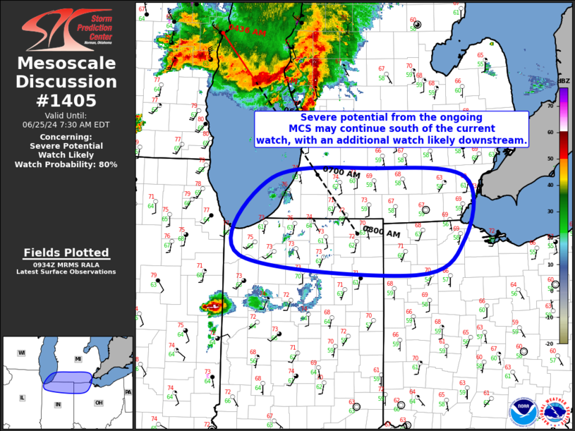
   SUMMARY...Severe potential from the ongoing MCS may extend into far
   southern lower MI, far northern IN, and potentially even far
   northwest OH. A downstream watch will likely be needed for portions
   of the area.

   DISCUSSION...Convective line ongoing from east-central WI across
   central Lake Michigan and into far western Lower MI continues to
   push southeastward at 50 to 55 kt. Despite an earlier trend towards
   potentially more southerly motion the MCS appears to be maintaining
   its more southeasterly trajectory, which would bring the MCS to the
   southern edge of Severe Thunderstorm Watch 455 at around 11Z. The
   expectation is for some severe potential to likely continue south of
   the watch. One limiting factor is that the current southeasterly
   motion takes displaces the line further from the better low-level
   moisture and buoyancy. However, given the organization and strength
   of the MCS, some severe threat will likely extend into far southern
   lower MI, far northern IN, and potentially even far northwest OH.

   ..Mosier/Edwards.. 06/25/2024

   ...Please see www.spc.noaa.gov for graphic product...

   ATTN...WFO...CLE...DTX...IWX...GRR...LOT...

   LAT...LON   42288672 42418492 42288338 41508340 41028424 41278727
               42288672
|
|
|
Top/All Mesoscale Discussions/Forecast Products/Home |
|


