| Mesoscale Discussion 1378 | |
| < Previous MD | |

|
|
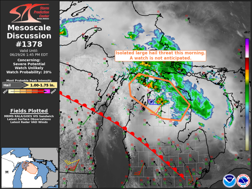
   Mesoscale Discussion 1378
   NWS Storm Prediction Center Norman OK
   1043 AM CDT Mon Jun 29 2026

   Areas affected...Northern Lower Michigan

   Concerning...Severe potential...Watch unlikely

   Valid 291543Z - 291745Z

   Probability of Watch Issuance...20 percent

   SUMMARY...Isolated occurrences of large hail are possible with the
   ongoing storms this morning. The limited areal coverage of the
   threat is expected to preclude a watch issuance.

   DISCUSSION...Elevated thunderstorms have persisted this morning
   across northern Lake Michigan into northern lower MI, with some of
   the storms exhibiting episodic supercellular characteristics. That
   convective activity is likely elevated on the northeast periphery of
   stronger mid-level capping and largely driven by low/mid-level warm
   advection per KAPX VWP. Model-derived forecast soundings and the
   observed wind profile data suggest the environment will remain
   supportive of periodic storm organization through the remainder of
   the morning with an attendant risk for large hail.

   ..Mead/Guyer.. 06/29/2026

   ...Please see www.spc.noaa.gov for graphic product...

   ATTN...WFO...APX...

   LAT...LON   45598628 45958581 45698432 44878335 44338380 44418467
               44828548 45188620 45598628

   MOST PROBABLE PEAK HAIL SIZE...1.00-1.75 IN
|
|
|
Top/All Mesoscale Discussions/Forecast Products/Home |
|
Source link