| Mesoscale Discussion 1368 | |
| < Previous MD | |

|
|
Mesoscale Discussion 1368
NWS Storm Prediction Center Norman OK
0220 PM CDT Sun Jun 28 2026
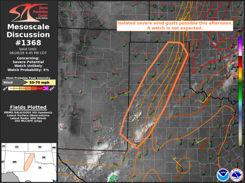
Areas affected...the Texas Panhandle into the Permian Basin and far
Southeast New Mexico
Concerning...Severe potential...Watch unlikely
Valid 281920Z - 282145Z
Probability of Watch Issuance...5 percent
SUMMARY...Isolated severe wind gusts appear possible this afternoon
with pulse-type thunderstorms. The limited nature of the threat is
expected to preclude a watch.
DISCUSSION...Recent visible satellite shows a growing cumulus field
across the TX South Plains, west-southwest of Lubbock. That
convection appears to be developing along the western edge of
stronger capping and within a deeply mixed boundary layer with
surface temperatures of around 100 F. Stronger instability resides
to the east with objective analysis indicating MLCAPE as high as
1500-2500 J/kg from the eastern TX Panhandle into the Low Rolling
Plains.
Continued daytime heating should allow for further convective
inhibition reduction from the west, which in turn will allow the
deepening convection to spread east into a progressively more
unstable environment. Vertical shear is expected to remain
relatively weak, which should limit the potential for organized
storm modes. Nonetheless, the presence of a moderately unstable
environment featuring a relatively deep, inverted-v boundary layer
will be supportive of isolated severe wind gusts with pulse-type
storms.
..Mead/Guyer.. 06/28/2026
...Please see www.spc.noaa.gov for graphic product...
ATTN...WFO...LUB...AMA...MAF...ABQ...
LAT...LON 33310325 34260276 35280213 36500107 36470042 35980008
33810125 32660200 32100262 32710342 33310325
MOST PROBABLE PEAK WIND GUST...55-70 MPH
|
|
|
Top/All Mesoscale Discussions/Forecast Products/Home |
|
Source link