|
|
| Mesoscale Discussion 1348 | |
| < Previous MD | |

|
|
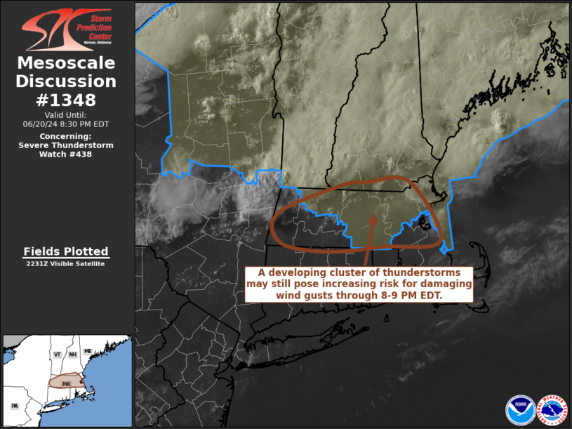
Mesoscale Discussion 1348 NWS Storm Prediction Center Norman OK 0535 PM CDT Thu Jun 20 2024 Areas affected...much of Massachusetts and adjacent southern New Hampshire Concerning...Severe Thunderstorm Watch 438... Valid 202235Z - 210030Z The severe weather threat for Severe Thunderstorm Watch 438 continues. SUMMARY...A developing cluster of thunderstorms may still pose increasing risk of producing damaging wind gusts while spreading southeastward across Massachusetts, perhaps including much of the Greater Boston vicinity, by 8-9 PM EDT. DISCUSSION...The boundary layer remains strongly heated (including surface temperatures near 90F) and characterized by seasonably high moisture content supportive of mixed-layer CAPE in excess of 2000 J/kg, along pre-frontal surface troughing inland of the southern New England coast. This is beneath prominent mid/upper ridging, but north of the ridge axis, where deep-layer westerly mean flow may be on the order of 15-20 kt. Aided by southerly low-level inflow of the unstable air, strengthening ongoing storms along a corridor southeast of Albany NY into the Keene NH vicinity may still undergo further intensification and upscale growth during the next hour or two. As this occurs, consolidating southeastward propagating outflow may be accompanied by increasing risk for potentially damaging wind gusts into the 00-01Z time frame. ..Kerr.. 06/20/2024 ...Please see www.spc.noaa.gov for graphic product... ATTN...WFO...GYX...BOX...ALY... LAT...LON 42427332 42777227 42807188 42827119 42117069 42037161 41987249 42077327 42427332 |
|
|
Top/All Mesoscale Discussions/Forecast Products/Home |
|


