|
|
| Mesoscale Discussion 1338 | |
| < Previous MD | |

|
|
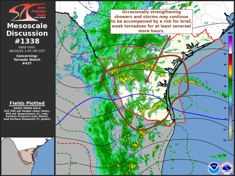
Mesoscale Discussion 1338 NWS Storm Prediction Center Norman OK 1144 PM CDT Wed Jun 19 2024 Areas affected...Deep South Texas Concerning...Tornado Watch 437... Valid 200444Z - 200645Z The severe weather threat for Tornado Watch 437 continues. SUMMARY...Occasionally strengthening showers and thunderstorms may continue to be accompanied by potential for a brief, weak tornado into the 1-3 AM CDT time frame. DISCUSSION...As Alberto slowly progresses toward the Mexican Gulf coast, a broad belt of moderately strong cyclonic easterly low-level flow (including 40-50 kt around 850 mb) will likely be maintained to its north, across and inland of Deep South Texas coastal areas into the overnight hours. Beneath this regime, moderately large clockwise-curved low-level hodographs may be maintained at least several more hours. Coupled with the potential for appreciable upward vertical motion within the lowest couple of kilometers above ground level, aided by the instability associated with a tropical moist boundary layer (including upper 70s to near 80F surface dew points), this will continue to contribute to an environment supportive of occasionally intensifying low-level mesocyclones within scattered inland progressing convection. ..Kerr.. 06/20/2024 ...Please see www.spc.noaa.gov for graphic product... ATTN...WFO...CRP...BRO... LAT...LON 27709991 28059863 28299699 27179662 26719719 26079757 25759871 27129981 27709991 |
|
|
Top/All Mesoscale Discussions/Forecast Products/Home |
|