|
|
| Mesoscale Discussion 1337 | |
| < Previous MD | |

|
|
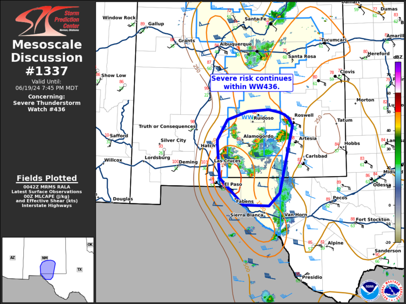
Mesoscale Discussion 1337 NWS Storm Prediction Center Norman OK 0744 PM CDT Wed Jun 19 2024 Areas affected...southern New Mexico into far western Texas Concerning...Severe Thunderstorm Watch 436... Valid 200044Z - 200145Z The severe weather threat for Severe Thunderstorm Watch 436 continues. SUMMARY...Large-hail and damaging-wind risk continues in WW436. DISCUSSION...Widely scattered thunderstorm activity continues within the southern portion of WW434. Storms within the northern portion of the watch have generally produced hail around 1-1.5 inches, through isolated hail up to 2 in was recorded near Torrance County, NM. A few more isolated cells continue within the northern fringes of the watch, but the air mass further north has largely been overturned by convection. The best instability remains from the Sacramento Mountains southward to the Guadalupe Mountains and into far western Texas, where surface objective analysis indicates around 1000-2000 J/kg of MLCAPE and 40-50 kts of deep layer shear. Recent gusts of 60-70 mph have been reported. Within this environment, the greatest short-term wind/hail threat will likely continue. ..Thornton.. 06/20/2024 ...Please see www.spc.noaa.gov for graphic product... ATTN...WFO...MAF...ABQ...EPZ... LAT...LON 31980658 32780666 32880665 33360637 33560579 33600522 33550492 33490477 33390464 33220454 31630492 31320522 31350593 31980658 |
|
|
Top/All Mesoscale Discussions/Forecast Products/Home |
|


