| Mesoscale Discussion 1324 | |
| < Previous MD Next MD > | |

|
|
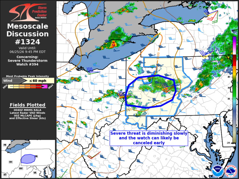
Mesoscale Discussion 1324 NWS Storm Prediction Center Norman OK 0743 PM CDT Thu Jun 25 2026 Areas affected...Western Pennsylvania Concerning...Severe Thunderstorm Watch 394... Valid 260043Z - 260145Z The severe weather threat for Severe Thunderstorm Watch 394 continues. SUMMARY...The threat for severe storms will continue to diminish slowly through early tonight, and the watch can likely be canceled by about 01-02z. DISCUSSION...With the loss of daytime heating, low-level static stability has already begun to slowly increase from PA into OH as surface temperatures cool. Widely scattered thunderstorms are still ongoing in an environment with sufficient vertical shear for supercells, but the storms are expected to slowly weaken and become rooted slightly above the surface with time. The overall severe threat has become marginal and the watch can likely be canceled by 01-02z. ..Thompson.. 06/26/2026 ...Please see www.spc.noaa.gov for graphic product... ATTN...WFO...CTP...PBZ... LAT...LON 40347815 40107872 40027946 40138048 40488054 40908036 41217987 41297885 41097806 40687797 40347815 MOST PROBABLE PEAK WIND GUST...UP TO 60 MPH |
|
|
Top/All Mesoscale Discussions/Forecast Products/Home |
|
Source link