|
|
| Mesoscale Discussion 1319 | |
| < Previous MD | |

|
|
   Mesoscale Discussion 1319
   NWS Storm Prediction Center Norman OK
   1254 PM CDT Tue Jun 18 2024

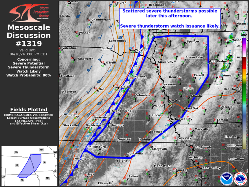
   Areas affected...eastern NE...western IA...and far north-central KS

   Concerning...Severe potential...Severe Thunderstorm Watch likely

   Valid 181754Z - 182000Z

   Probability of Watch Issuance...80 percent

   SUMMARY...Scattered to widespread thunderstorms are expected along
   and ahead of a cold front moving across the Mid-Missouri Valley.
   While large hail and a tornado or two are possible, scattered gusts
   of 55-70 mph should be the primary threat. A severe thunderstorm
   watch will be likely by 1930Z.

   DISCUSSION...A swelling Cu field with incipient Cb development is
   underway along an east-southeast moving cold front that arcs from
   far eastern SD through south-central NE. 17Z SPC mesoanalysis
   indicates MLCIN is becoming negligible along the NE portion of the
   front with MLCAPE of 2000-2500 J/kg amid low 70s surface dew points
   ahead of it. Deep-layer wind profiles are largely aligned to the
   frontal orientation, with stronger mid to upper flow also lagging
   west of it. Still, enough shear in conjunction with the moderately
   large MLCAPE should prove sufficient for multicell clustering as
   convection spreads towards/across the Mid-MO Valley. Some
   enlargement to the low-level hodograph should support transient
   mesovortices and embedded supercells. A threat for a tornado or two
   in addition to large hail will be possible, but scattered wind gusts
   from 55-70 mph should be the overarching hazard into early evening.

   ..Grams/Gleason.. 06/18/2024

   ...Please see www.spc.noaa.gov for graphic product...

   ATTN...WFO...DMX...EAX...FSD...OAX...TOP...GID...

   LAT...LON   43409582 43369418 42119421 40779538 39499751 39519892
               39729936 40429861 42279717 43339655 43409582
|
|
|
Top/All Mesoscale Discussions/Forecast Products/Home |
|


