| Mesoscale Discussion 1313 | |
| < Previous MD Next MD > | |

|
|
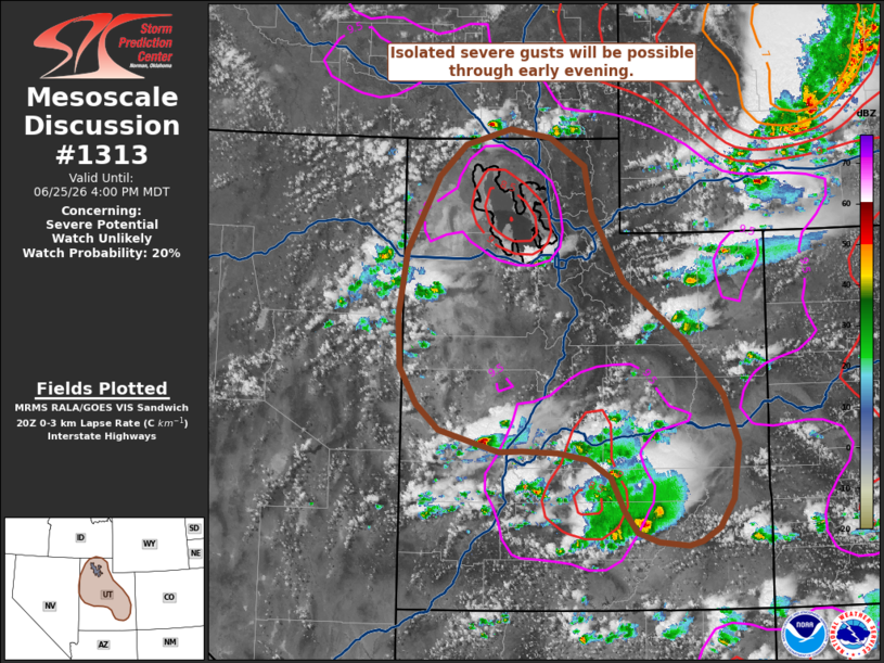
   Mesoscale Discussion 1313
   NWS Storm Prediction Center Norman OK
   0304 PM CDT Thu Jun 25 2026

   Areas affected...Utah

   Concerning...Severe potential...Watch unlikely

   Valid 252004Z - 252200Z

   Probability of Watch Issuance...20 percent

   SUMMARY...Severe downburst winds will be possible through early
   evening. However, this threat should be sufficiently scattered to
   preclude watch issuance.

   DISCUSSION...Regional radar and GOES IR imagery depicts steady
   strengthening of convection across eastern NV into central and
   northwest UT. Concurrently, mostly clear skies and strong diurnal
   heating downstream has allowed for temperatures to climb into the
   upper 80s and low 90s, which has nearly eliminated MLCIN based on
   the 18 UTC SLC sounding. This RAOB also depicted a fairly dry
   boundary layer with 0-3 km lapse rates of nearly 9 C/km that will be
   favorable for downdraft accelerations and strong to severe downburst
   winds. Consequently, the potential for severe wind gusts should
   increase over the next few hours as developing convection continues
   to intensify and spreads east/northeast through early evening.
   Latest time-lagged ensemble guidance appears to be capturing current
   convective trends well and suggests that convective coverage should
   remain sufficiently isolated to preclude watch issuance, but gusts
   up to 60-70 mph appear possible with the strongest storms.

   ..Moore/Guyer.. 06/25/2026

   ...Please see www.spc.noaa.gov for graphic product...

   ATTN...WFO...GJT...SLC...PIH...LKN...

   LAT...LON   37870972 37720996 37681015 37721055 37821084 38051102
               38401119 38601150 38671190 38681240 38681271 38771304
               38911353 39181384 39571407 40111410 40791400 41591355
               41931319 42091258 42001201 41701154 41201143 40491101
               39851017 39270965 38760946 38160954 37870972
|
|
|
Top/All Mesoscale Discussions/Forecast Products/Home |
|
Source link