|
|
| Mesoscale Discussion 1264 | |
| < Previous MD | |

|
|
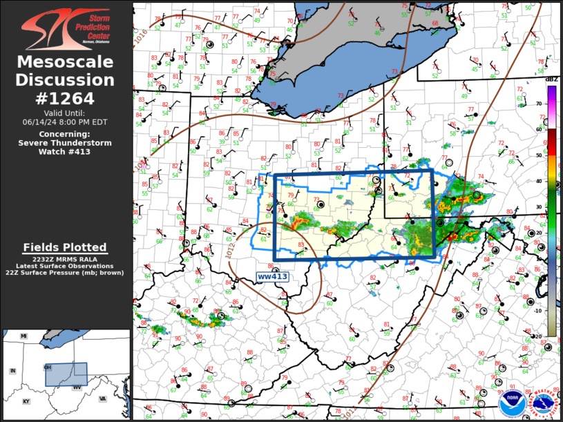
Mesoscale Discussion 1264 NWS Storm Prediction Center Norman OK 0536 PM CDT Fri Jun 14 2024 Areas affected...Ohio Valley Concerning...Severe Thunderstorm Watch 413... Valid 142236Z - 150000Z The severe weather threat for Severe Thunderstorm Watch 413 continues. SUMMARY...Isolated severe thunderstorms will propagate south across ww413 this evening. DISCUSSION...Northwest flow is deepening across the Ohio Valley early this evening as a pronounced short-wave rough and affiliated mid-level speed max dig southeast across OH/western PA. Primary zone of low-level confluence has now shifted to near the Ohio River and ongoing isolated severe storms, a few supercellular, will propagate south along with it. Hail is the primary risk along with gusty winds, but this activity should gradually encounter less buoyant air, especially over WV where surface dew points are notably lower. ..Darrow.. 06/14/2024 ...Please see www.spc.noaa.gov for graphic product... ATTN...WFO...LWX...PBZ...RLX...CLE...ILN... LAT...LON 39008287 40438290 40507947 39057946 39008287 |
|
|
Top/All Mesoscale Discussions/Forecast Products/Home |
|


