|
|
| Mesoscale Discussion 1251 | |
| < Previous MD | |

|
|
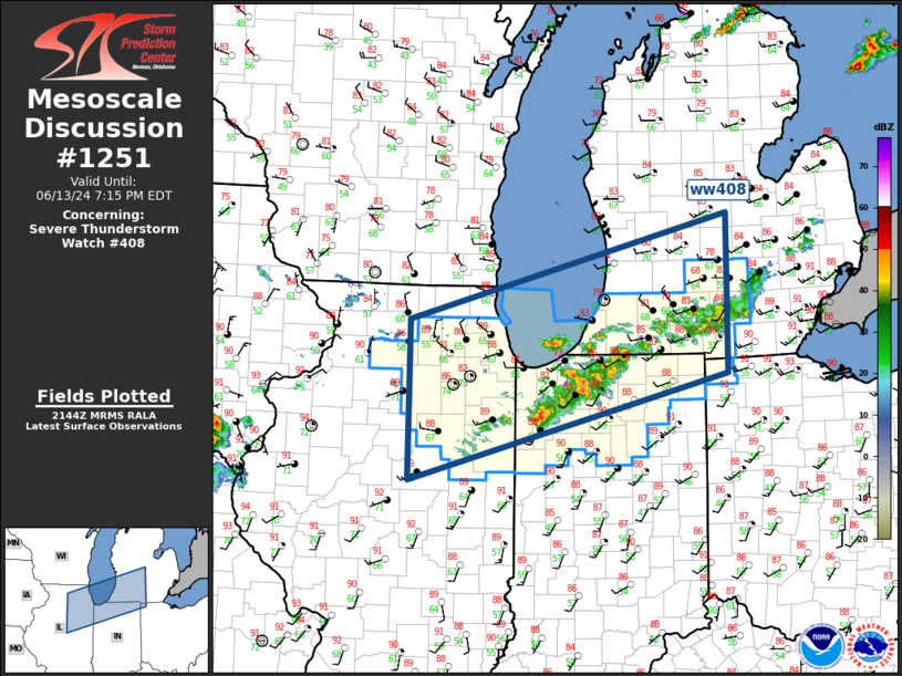
Mesoscale Discussion 1251 NWS Storm Prediction Center Norman OK 0446 PM CDT Thu Jun 13 2024 Areas affected...Southern Great Lakes Concerning...Severe Thunderstorm Watch 408... Valid 132146Z - 132315Z The severe weather threat for Severe Thunderstorm Watch 408 continues. SUMMARY...Broken squall line will propagate southeast this evening with an attendant risk for locally damaging winds and some hail risk. DISCUSSION...Great Lakes short-wave trough is progressing across WI toward Lower MI this evening. This feature appears to be partly responsible for scattered strong/severe thunderstorms that have developed along a prefrontal boundary that is draped from southern Lower MI into northeast IL. This boundary is coincident with the primary axis of instability, albeit notably weaker across northern IN/southern MI. This activity will soon advance beyond the greater zone of instability and gradual weakening is expected as the broken squall line shifts into a region of lower surface dew points. ..Darrow.. 06/13/2024 ...Please see www.spc.noaa.gov for graphic product... ATTN...WFO...IWX...GRR...LOT...ILX... LAT...LON 42128905 43288446 41558447 40388904 42128905 |
|
|
Top/All Mesoscale Discussions/Forecast Products/Home |
|