| Mesoscale Discussion 1174 | |
| < Previous MD | |

|
|
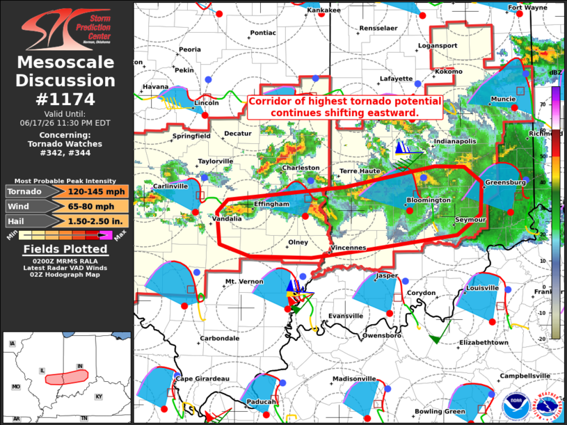
Mesoscale Discussion 1174 NWS Storm Prediction Center Norman OK 0903 PM CDT Wed Jun 17 2026 Areas affected...Southeast Illinois into southern Indiana Concerning...Tornado Watch 342...344... Valid 180203Z - 180330Z The severe weather threat for Tornado Watch 342, 344 continues. SUMMARY...The corridor of highest tornado potential continues to shift eastward across southeastern Illinois and southern Indiana -- within Tornado Watches 342/344. DISCUSSION...An east/west-oriented band of tornadic supercells continues tracking east-southeastward across southeastern IL into southern IN -- along the southern periphery of a lingering larger convective cluster. These storms now have access to fully recovered PBL air (upper 70s to lower 80s temperatures amid upper 60s dewpoints). Given a large, clockwise curved hodograph sampled by nearby VWPs (likely around 600 m2/s2 effective SRH), the tornado risk risk (some strong to intense) will continue tonight. ..Weinman.. 06/18/2026 ...Please see www.spc.noaa.gov for graphic product... ATTN...WFO...IND...ILX...LSX... LAT...LON 38708698 38858584 39068553 39398550 39548573 39558612 39348731 39218886 39078900 38748897 38628856 38618776 38708698 MOST PROBABLE PEAK TORNADO INTENSITY...120-145 MPH MOST PROBABLE PEAK WIND GUST...65-80 MPH MOST PROBABLE PEAK HAIL SIZE...1.50-2.50 IN |
|
|
Top/All Mesoscale Discussions/Forecast Products/Home |
|
Source link