|
|
| Mesoscale Discussion 1171 | |
| < Previous MD | |

|
|
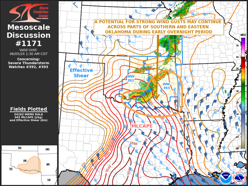
Mesoscale Discussion 1171 NWS Storm Prediction Center Norman OK 1128 PM CDT Tue Jun 04 2024 Areas affected...Southern and Eastern Oklahoma...North Texas...Far Western Arkansas Concerning...Severe Thunderstorm Watch 392...393... Valid 050428Z - 050630Z The severe weather threat for Severe Thunderstorm Watch 392, 393 continues. SUMMARY...A linear MCS, associated with strong wind gusts, will move across southern and eastern Oklahoma over the next few hours, and into far north Texas and far western Arkansas later tonight. Although intensity with the line has decreased, there still remains a possibility that the line could re-generate during the overnight period. DISCUSSION...Latest mosaic radar imagery shows a line of strong thunderstorms over southern and east-central Oklahoma. This line is associated with a linear MCS that is located near the northern edge of a strongly unstable airmass. Immediately to the south of the MCS, MLCAPE is estimated by the RAP to be in the 3500 to 5000 J/kg range. RAP forecast soundings overnight within this airmass near the Red River and in eastern Oklahoma have substantial directional shear in the lowest 3 km, which combined with the strong instability, suggests the line could be associated with a few marginally severe wind gusts. It still remains possible the line could re-generate as it moves southeastward along the instability gradient. ..Broyles.. 06/05/2024 ...Please see www.spc.noaa.gov for graphic product... ATTN...WFO...LZK...SHV...TSA...FWD...OUN... LAT...LON 34069848 33499726 33299578 33459464 33769422 34499415 35529423 36039486 36109550 35879602 35609642 35249669 34919693 34859789 34629856 34069848 |
|
|
Top/All Mesoscale Discussions/Forecast Products/Home |
|


