|
|
| Mesoscale Discussion 1168 | |
| < Previous MD Next MD > | |

|
|
   Mesoscale Discussion 1168
   NWS Storm Prediction Center Norman OK
   0616 PM CDT Tue Jun 04 2024

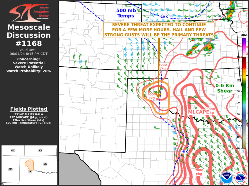
   Areas affected...Eastern Texas Panhandle

   Concerning...Severe potential...Watch unlikely

   Valid 042316Z - 050115Z

   Probability of Watch Issuance...20 percent

   SUMMARY...An isolated severe threat, with a potential for hail and
   strong wind gusts, may continue for a few more hours across the
   eastern Texas Panhandle. At this time, convective coverage is
   expected to decrease in the mid to late evening. If it appears that
   the convection will last longer than expected, then watch issuance
   would need to be considered.

   DISCUSSION...The latest hi-resolution radar imagery from Amarillo
   shows a widely-spaced line of strong thunderstorms over the central
   and eastern Texas Panhandle. The convection is being supported by
   lift just ahead of a vorticity max moving southeastward across the
   Oklahoma Panhandle. The latest surface analysis has a 996 mb low
   over northwest Texas with northerly flow located across much of the
   Texas Panhandle. A corridor of locally higher surface dewpoints
   extends westward into the northern Texas Panhandle, where the RAP is
   estimating MLCAPE in the 2000 to 3000 J/kg range. In addition to the
   instability, forecast soundings across the northeastern Texas
   Panhandle have 700-500 mb lapse rates near 7.5 C/km, which could be
   enough for a hail threat with the stronger cells. A few strong wind
   gusts will also be possible. Cells are expected to persist for a few
   more hours, but that the cap is expected to re-build into the
   eastern Texas Panhandle by mid evening, causing convective coverage
   to decrease.

   ..Broyles/Hart.. 06/04/2024

   ...Please see www.spc.noaa.gov for graphic product...

   ATTN...WFO...OUN...LUB...AMA...

   LAT...LON   35390184 35740183 36050146 36330083 36300038 36130002
               35749994 34939996 34440005 34370052 34510090 35070129
               35390184
|
|
|
Top/All Mesoscale Discussions/Forecast Products/Home |
|


