|
|
| Mesoscale Discussion 1156 | |
| < Previous MD | |

|
|
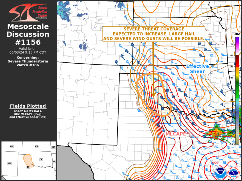
Mesoscale Discussion 1156 NWS Storm Prediction Center Norman OK 0716 PM CDT Mon Jun 03 2024 Areas affected...Central and Eastern Texas Panhandle...Far Western Oklahoma Concerning...Severe Thunderstorm Watch 386... Valid 040016Z - 040215Z The severe weather threat for Severe Thunderstorm Watch 386 continues. SUMMARY...The severe threat is expected to increase in coverage across parts of the central and eastern Texas Panhandle over the next few hours. Isolated large hail and wind damage will be the primary threats. DISCUSSION...The latest hi-resolution radar imagery from Amarillo shows multiple isolated severe storms ongoing across the central and eastern Texas Panhandle. The storms are located along and near an axis of strong instability, where the RAP has MLCAPE in the 2000 to 4000 J/kg range. A shortwave trough, evident on water vapor imagery, appears to be moving through the Texas Panhandle. Large-scale ascent associated with the trough will likely support a gradual increase in convective coverage over the next few hours. RAP forecast soundings early this evening in the eastern Texas Panhandle have 0-6 km shear near 40 knots and 700-500 mb lapse rates near 8 C/km. This will support an isolated large-hail threat with supercells. As cells mature early this evening, a threat for severe wind gusts will also be possible. Low-level shear will also be strong enough for an isolated tornado threat with any storm that can become dominant. ..Broyles.. 06/04/2024 ...Please see www.spc.noaa.gov for graphic product... ATTN...WFO...OUN...LUB...AMA... LAT...LON 36440008 36490073 36310134 35760170 34700113 33940010 33949931 34449909 35019950 36109977 36440008 |
|
|
Top/All Mesoscale Discussions/Forecast Products/Home |
|


