|
|
| Mesoscale Discussion 1135 | |
| < Previous MD | |

|
|
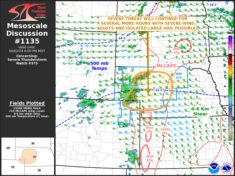
Mesoscale Discussion 1135 NWS Storm Prediction Center Norman OK 0500 PM CDT Sun Jun 02 2024 Areas affected...Far Northeast Colorado...Western and Central Nebraska Concerning...Severe Thunderstorm Watch 375... Valid 022200Z - 030000Z The severe weather threat for Severe Thunderstorm Watch 375 continues. SUMMARY...A severe threat is likely to continue for several more hours from far northeast Colorado into western and central Nebraska. Large hail and severe wind gusts will be the primary threats. DISCUSSION...The latest hi-resolution radar imagery from North Platte shows a cluster of strong to severe thunderstorms in far northeast Colorado and western Nebraska, where at least two supercells are ongoing. The storms are located along the western edge of a moist airmass. Surface dewpoints within this airmass are in the lower 60s F and the RAP is analyzing MLCAPE in the 2000 to 3000 J/kg range. As the storms move eastward into more instability over the next few hours, the overall intensity of the cluster is expected to be maintained. The 20Z special sounding at North Platte, NE and RAP forecast soundings into early evening in same area have 0-6 km shear of 40 to 45 knots with 700-500 mb lapse rates around 8.5 C/km. This will support supercell development, with a potential for isolated large hail and severe wind gusts. The threat for severe gusts may increase if a cold pool can organize across western and central Nebraska. ..Broyles.. 06/02/2024 ...Please see www.spc.noaa.gov for graphic product... ATTN...WFO...GID...LBF...BOU...CYS... LAT...LON 40610033 40430136 40500246 40590293 40840330 41240312 41720260 42200250 42490238 42680185 42720086 42620001 42299960 41759953 41029979 40610033 |
|
|
Top/All Mesoscale Discussions/Forecast Products/Home |
|


