|
|
| Mesoscale Discussion 1122 | |
| < Previous MD | |

|
|
   Mesoscale Discussion 1122
   NWS Storm Prediction Center Norman OK
   0254 AM CDT Sun Jun 02 2024

   Areas affected...southeast NE and northeast KS

   Concerning...Severe potential...Watch unlikely

   Valid 020754Z - 020930Z

   Probability of Watch Issuance...20 percent

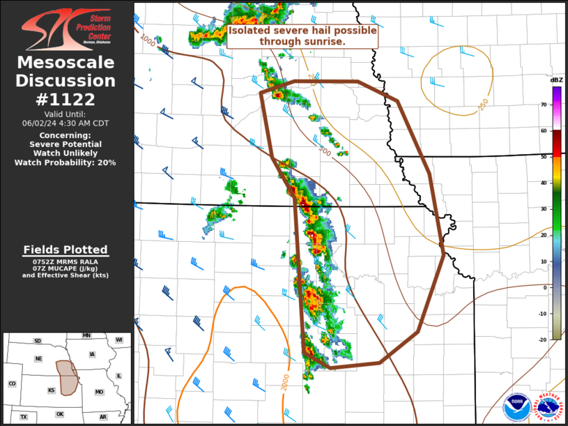
   SUMMARY...Isolated severe hail will be possible through about
   sunrise with an arc of elevated thunderstorms across northeast
   Kansas to southeast Nebraska.

   DISCUSSION...Nearly simultaneous to the decay of an MCS over
   southwest KS/northwest OK, a band of elevated convection intensified
   across northeast KS/southeast NE. This activity appears to be driven
   by low-level warm theta-e advection along the MUCAPE gradient. While
   the 06Z HRRR has minimal reflection of this development, the
   Hastings and Topeka VWPs indicate moderate low-level
   south-southwesterly flow. Moderate upper-level west-northwesterlies
   will remain adequate for transient supercell structures and hail
   growth. Still, the cluster to loosely linear convective mode should
   temper peak hail sizes to the 1-1.5 inches in diameter range.

   ..Grams/Thompson.. 06/02/2024

   ...Please see www.spc.noaa.gov for graphic product...

   ATTN...WFO...EAX...OAX...TOP...ICT...GID...

   LAT...LON   40109730 40569764 41319783 41459731 41469634 41229573
               40389524 39439504 38549544 38189602 38119674 38309714
               40109730
|
|
|
Top/All Mesoscale Discussions/Forecast Products/Home |
|


