|
|
| Mesoscale Discussion 1116 | |
| < Previous MD | |

|
|
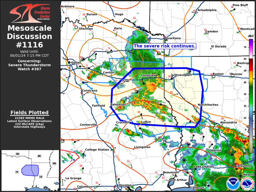
Mesoscale Discussion 1116 NWS Storm Prediction Center Norman OK 0541 PM CDT Sat Jun 01 2024 Areas affected...parts of eastern TX and western LA Concerning...Severe Thunderstorm Watch 367... Valid 012241Z - 020015Z The severe weather threat for Severe Thunderstorm Watch 367 continues. SUMMARY...The risk for damaging winds and some hail may continue into the early evening. Storms should gradually weaken to the east. DISCUSSION...Across WW367, the ongoing cluster of severe storms appears likely to continue posing a risk for damaging winds and hail for another couple of hours. The primary supercells responsible for the earlier significant hail reports have shown a tendency for clustering and upscale growth over the last couple of hours. Recent observational trends strongly suggest this will continue with the evolving cluster encountering outflow from another cluster of storms farther south and east. Continued upscale growth is likely as they track eastward toward the TX/LA border. Given the change in storm mode, the risk for damaging winds appears to be increasing, though some hail risk will likely remain possible. Storms should begin to slowly weaken as the continue eastward toward the eastern edge of WW367 this evening. ..Lyons.. 06/01/2024 ...Please see www.spc.noaa.gov for graphic product... ATTN...WFO...LCH...SHV...HGX...FWD... LAT...LON 31429532 31739558 32199556 32729494 32729338 32649300 32189291 31429300 31269314 31279358 31339490 31429532 |
|
|
Top/All Mesoscale Discussions/Forecast Products/Home |
|


