|
|
| Mesoscale Discussion 1109 | |
| < Previous MD Next MD > | |

|
|
   Mesoscale Discussion 1109
   NWS Storm Prediction Center Norman OK
   0136 PM CDT Sat Jun 01 2024

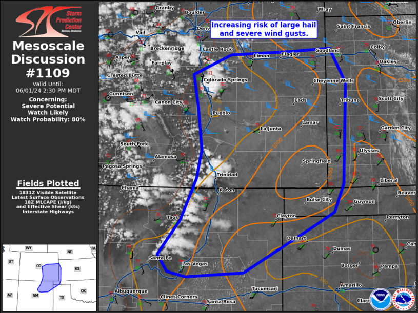
   Areas affected...northeast New Mexico...eastern Colorado...western
   Kansas...and the western OK Panhandle

   Concerning...Severe potential...Watch likely

   Valid 011836Z - 012030Z

   Probability of Watch Issuance...80 percent

   SUMMARY...The threat for large hail and severe wind gusts is
   increasing across northeast New Mexico and eastern Colorado.

   DISCUSSION...Convection has started to form along the Front Range
   from central Colorado to northern New Mexico. Currently, the
   environment east of the mountains remains capped amid a well-mixed
   atmosphere. Another hour or two of heating should erode inhibition
   across this region and permit strong to severe storm development
   east of the mountains. Effective shear remains sufficiently strong
   (35-40 knots per SPC mesoanalysis) to support rotating updrafts
   across central Colorado with decreasing shear farther south.
   Initially, the threat will be large hail (some 2+ inch where
   supercell mode is favored), but severe wind will also be a threat
   given the inverted-v soundings, favorable for strong downdrafts.
   Eventually, expect storms to congeal into a few clusters by this
   evening with an increasing severe wind threat. A severe thunderstorm
   watch will be needed by mid-afternoon to address the threat from
   these storms.

   ..Bentley/Smith.. 06/01/2024

   ...Please see www.spc.noaa.gov for graphic product...

   ATTN...WFO...DDC...GLD...AMA...PUB...BOU...ABQ...

   LAT...LON   35810574 36430526 37160491 37660480 38400490 38980501
               39340417 39390283 39440196 38840160 37060168 36560189
               36370224 35510387 35430513 35510552 35810574
|
|
|
Top/All Mesoscale Discussions/Forecast Products/Home |
|


