|
|
| Mesoscale Discussion 1103 | |
| < Previous MD | |

|
|
   Mesoscale Discussion 1103
   NWS Storm Prediction Center Norman OK
   0311 AM CDT Sat Jun 01 2024

   Areas affected...NE Panhandle

   Concerning...Severe potential...Watch possible

   Valid 010811Z - 011015Z

   Probability of Watch Issuance...40 percent

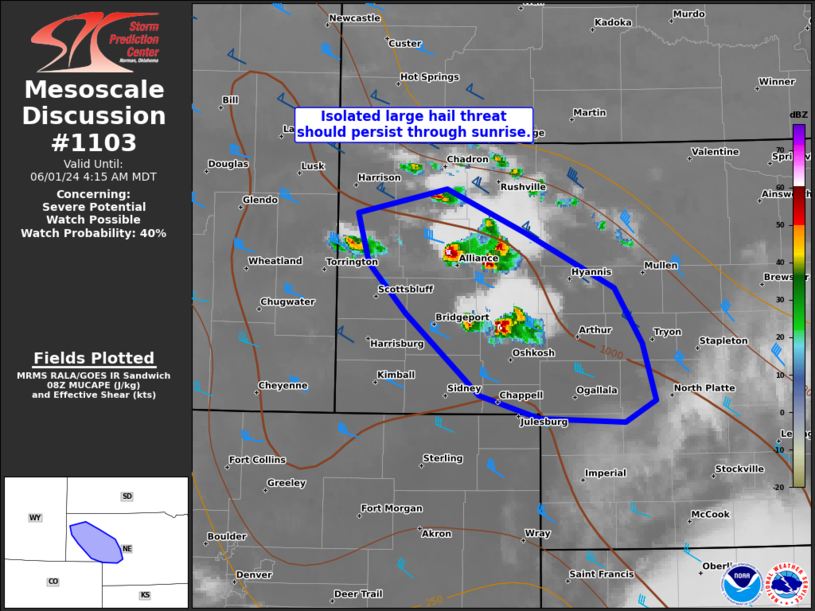
   SUMMARY...Potential for isolated large hail should persist through
   sunrise with a few elevated supercells across the western Nebraska
   Panhandle vicinity.

   DISCUSSION...A trio of elevated supercells have formed as a result
   of a well-advertised overnight increase in low-level moisture
   northward over the central High Plains. The northwestern most of
   this trio, near Alliance, appears to be the deepest updraft. With
   MUCAPE having increased to about 1000 J/kg coupled with moderate
   northwesterly deep-layer shear, the threat for large hail will
   probably persist for a few hours through at least sunrise. Low-level
   flow appears to be relatively modest, yielding some uncertainty on
   how long the severe hail threat will last. 00Z HREF signal suggests
   relatively shorter-lived supercells should be expected, although the
   00Z NSSL-MPAS runs indicated potential for a longer-lived, more
   intense storm occurring.

   ..Grams/Thompson.. 06/01/2024

   ...Please see www.spc.noaa.gov for graphic product...

   ATTN...WFO...LBF...BOU...CYS...

   LAT...LON   42660296 42330220 41930131 41520105 41100092 40930121
               40970205 41140265 41730336 42100373 42470385 42660296
|
|
|
Top/All Mesoscale Discussions/Forecast Products/Home |
|


