|
|
| Mesoscale Discussion 1082 | |
| < Previous MD | |

|
|
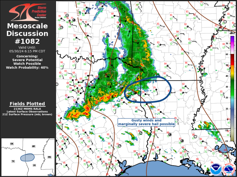
Mesoscale Discussion 1082 NWS Storm Prediction Center Norman OK 0439 PM CDT Thu May 30 2024 Areas affected...Arklatex Region Concerning...Severe potential...Watch possible Valid 302139Z - 302315Z Probability of Watch Issuance...40 percent SUMMARY...Convection will spread across the Arklatex region over the next few hours. Gusty winds along with marginally severe hail are expected. Some consideration is being given to a new watch immediately downstream of ww0353. DISCUSSION...Remnants of pre-dawn MCS that developed over the southern High Plains have propagated downstream into the Arklatex region. Diurnal heating and weak inhibition have contributed to renewed development along the leading edge of this long-lived MCS. Surface temperatures have warmed into the lower 80s ahead of this activity across northern LA/southern AR which is contributing to MLCAPE on the order of 1500-2000 J/kg within a modestly sheared environment. Additionally, latest water-vapor imagery/model guidance suggest a weak short-wave trough is associated with this convection which should encourage further advancement downstream into an air mass that will support robust updrafts. Current thinking is marginally severe hail is possible along with gusty winds. Some consideration is being given to a new watch immediately downstream of ww0353. ..Darrow/Hart.. 05/30/2024 ...Please see www.spc.noaa.gov for graphic product... ATTN...WFO...SHV... LAT...LON 32779466 33179319 32719260 32209309 32199456 32779466 |
|
|
Top/All Mesoscale Discussions/Forecast Products/Home |
|


