| Mesoscale Discussion 108 | |
| < Previous MD | |

|
|
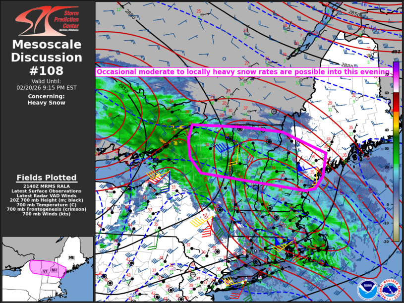
   Mesoscale Discussion 0108
   NWS Storm Prediction Center Norman OK
   0342 PM CST Fri Feb 20 2026

   Areas affected...Northeast NY into VT/NH/southern ME

   Concerning...Heavy snow

   Valid 202142Z - 210215Z

   SUMMARY...Occasional moderate to locally heavy snow rates are
   possible into this evening.

   DISCUSSION...Sporadic moderate to locally heavy snow is ongoing late
   this afternoon from parts of northeast NY into VT/NH. Favorable deep
   ascent downstream of a midlevel cyclone over lower MI will allow the
   extensive precipitation shield to spread northeastward into this
   evening across parts of northern NY and New England. In addition, an
   embedded shortwave trough that is currently producing shallow
   convection across western NY may help to enhance precipitation rates
   for a time this evening.

   Low-level temperatures remain relatively warm across parts of New
   England, but continued ascent and evaporative cooling should help to
   maintain snow as the primary precipitation type from northern NY
   into much of VT/NH. Substantial cooling aloft is also expected from
   west to east this evening, which could lead to an increase in
   snow-to-liquid ratios prior to cessation of the heavier
   precipitation rates. Farther east, gradually backing surface winds
   in response to a deepening cyclone off of the southern New England
   coast will eventually lead to low-level cold advection across areas
   of southern ME that are currently above freezing.

   Occasional moderate to locally heavy snow rates are expected to
   continue and expand into a larger portion of northern NY into VT/NH
   and southern ME this evening, before an anticipated weakening trend
   near/after 03Z as the stronger ascent begins to wane and shift
   offshore.

   ..Dean.. 02/20/2026

   ...Please see www.spc.noaa.gov for graphic product...

   ATTN...WFO...GYX...BTV...ALY...

   LAT...LON   43547302 43717453 44137493 44597502 45007488 44967303
               44817150 44246991 43627003 43307033 43257071 43387163
               43547302
|
|
|
Top/All Mesoscale Discussions/Forecast Products/Home |
|
Source link