|
|
| Mesoscale Discussion 1056 | |
| < Previous MD | |

|
|
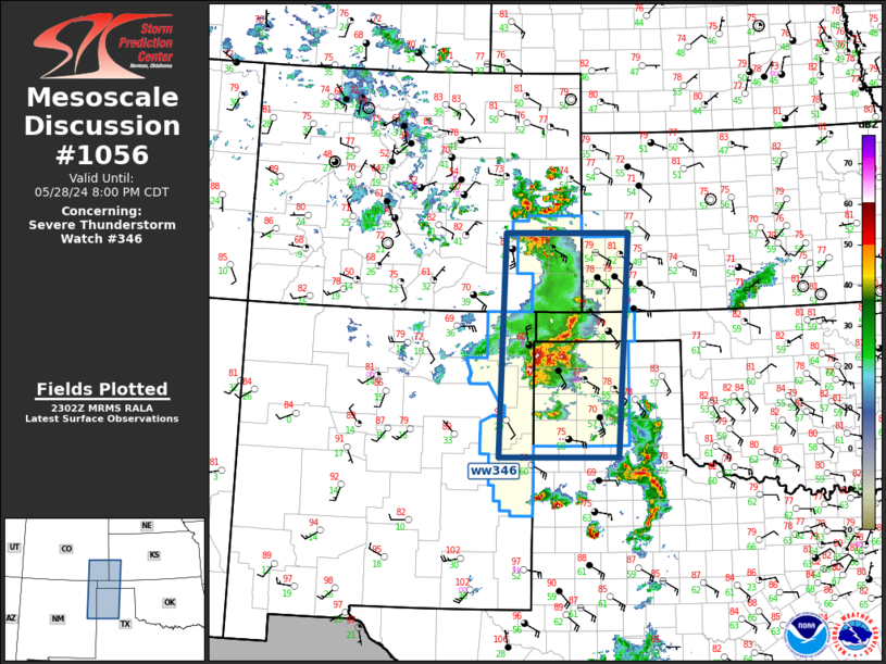
Mesoscale Discussion 1056 NWS Storm Prediction Center Norman OK 0605 PM CDT Tue May 28 2024 Areas affected...Southern High Plains Concerning...Severe Thunderstorm Watch 346... Valid 282305Z - 290100Z The severe weather threat for Severe Thunderstorm Watch 346 continues. SUMMARY...Severe risk will concentrate across central and eastern portions of ww0346 over the next few hours. Hail remains the primary threat. DISCUSSION...Multiple storm mergers, and significant convective overturning, have stabilized portions of the southern TX Panhandle and southeast CO. Over the last hour or so, a significant cluster of storms has evolved over the western OK and northwestern TX Panhandles region. This activity may begin to propagate east into portions of ww0346 that have yet to experience significant convection, especially the northern TX Panhandle into the central OK Panhandle. Large hail is the primary threat. ..Darrow.. 05/28/2024 ...Please see www.spc.noaa.gov for graphic product... ATTN...WFO...DDC...GLD...LUB...AMA...PUB...ABQ... LAT...LON 34550375 38310364 38310106 34550129 34550375 |
|
|
Top/All Mesoscale Discussions/Forecast Products/Home |
|


