|
|
| Mesoscale Discussion 1037 | |
| < Previous MD | |

|
|
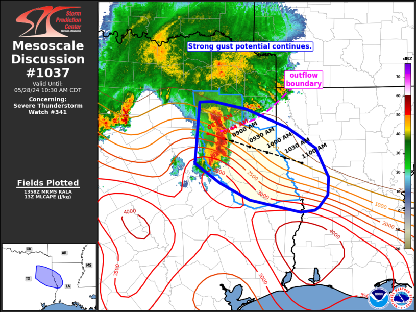
Mesoscale Discussion 1037 NWS Storm Prediction Center Norman OK 0900 AM CDT Tue May 28 2024 Areas affected...northeast Texas into western Louisiana Concerning...Severe Thunderstorm Watch 341... Valid 281400Z - 281530Z The severe weather threat for Severe Thunderstorm Watch 341 continues. SUMMARY...Strong gusts of 45-65 mph remain possible with east/southeast propagating bow over northeast Texas. DISCUSSION...An organized and strong bow continues to shift east/southeast across northeast TX along an instability gradient. Recent radar data shows an outflow boundary associated with an area of convection to the northeast of the bow surging southeast and intersecting the bow near its apex. This may have a deleterious impact on the organization of the bow over the next hour. The strongest measured gust noted in the past 30-60 minutes was a 47 kt gust at KTYR. Strong to severe gusts of 45 to 65 mph and isolated hail remain possible in the near term. Trends will be monitored for possible downstream watch issuance into parts of western/central LA. ..Leitman.. 05/28/2024 ...Please see www.spc.noaa.gov for graphic product... ATTN...WFO...LCH...SHV...HGX...FWD... LAT...LON 32789552 32789526 32669462 32359382 32019327 31539304 31249306 31049323 31009331 30969358 31169455 31459513 31769560 32789552 |
|
|
Top/All Mesoscale Discussions/Forecast Products/Home |
|


