|
|
| Mesoscale Discussion 1036 | |
| < Previous MD | |

|
|
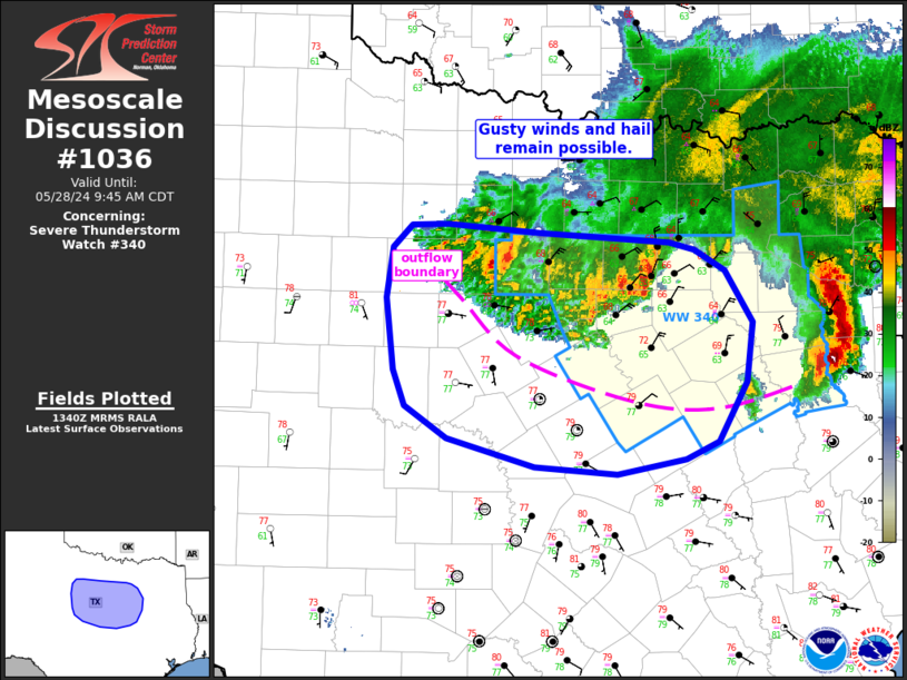
Mesoscale Discussion 1036 NWS Storm Prediction Center Norman OK 0843 AM CDT Tue May 28 2024 Areas affected...north Texas Concerning...Severe Thunderstorm Watch 340... Valid 281343Z - 281445Z The severe weather threat for Severe Thunderstorm Watch 340 continues. SUMMARY...Strong gusts and hail remain possible with storms across WW 340. DISCUSSION...Outflow associated with the intense bow that moved through the Metroplex earlier this morning has surged south of ongoing convection from Stephens to Tarrant Counties in north Texas. Ongoing convection is elevated behind this cooler outflow. Marginally severe hail may still accompany the stronger cells within this cluster, along with gusty winds, though the overall severe risk is lower behind the outflow. Gusty winds also will be possible with the outflow itself as it continues to shift south/southwest through the morning. A very moist and unstable airmass is in place ahead of the outflow. The area will be monitored for potential redevelopment later this morning or afternoon along this boundary. ..Leitman.. 05/28/2024 ...Please see www.spc.noaa.gov for graphic product... ATTN...WFO...FWD...SJT... LAT...LON 31129819 31359902 31619942 31899953 32479961 32899954 33069937 33079902 33009815 32929691 32869668 32699638 32279613 31809618 31319645 31189676 31069742 31129819 |
|
|
Top/All Mesoscale Discussions/Forecast Products/Home |
|