|
|
| Mesoscale Discussion 1032 | |
| < Previous MD | |

|
|
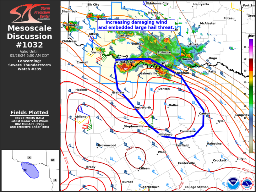
Mesoscale Discussion 1032 NWS Storm Prediction Center Norman OK 0325 AM CDT Tue May 28 2024 Areas affected...North TX Concerning...Severe Thunderstorm Watch 339... Valid 280825Z - 281000Z The severe weather threat for Severe Thunderstorm Watch 339 continues. SUMMARY...An increasing threat for severe wind gusts and large hail is expected farther south in north Texas through sunrise. An additional severe thunderstorm watch or extension of ongoing WW 339 is likely. DISCUSSION...The deepest/most intense thunderstorms within WW 339 were centered over Clay County, TX. Recent radar evolution suggest this activity is beginning to pivot southeastward towards the large CAPE reservoir emanating north from central TX. While CAM guidance has been slow with the evolution of early morning convection, the 07Z HRRR run finally appears more consistent with the 00Z NSSL-MPAS runs in indicating a substantial linear cluster accelerating southeastward across parts of the Metroplex. With deepening convective cores to its east, within the downstream warm-advection flank and the FWS VWP sampling the strongest low-level jet of the night (around 40 kts), this scenario appears increasingly plausible. Damaging gusts could reach 65-80 mph as the cold pool matures towards sunrise. ..Grams.. 05/28/2024 ...Please see www.spc.noaa.gov for graphic product... ATTN...WFO...FWD...OUN... LAT...LON 34059777 34059737 33599639 32699570 32299571 32039600 31949643 32029698 32309740 32929800 33269838 33829850 34029844 34059777 |
|
|
Top/All Mesoscale Discussions/Forecast Products/Home |
|


