|
|
| Mesoscale Discussion 1018 | |
| < Previous MD Next MD > | |

|
|
   Mesoscale Discussion 1018
   NWS Storm Prediction Center Norman OK
   0248 PM CDT Mon May 27 2024

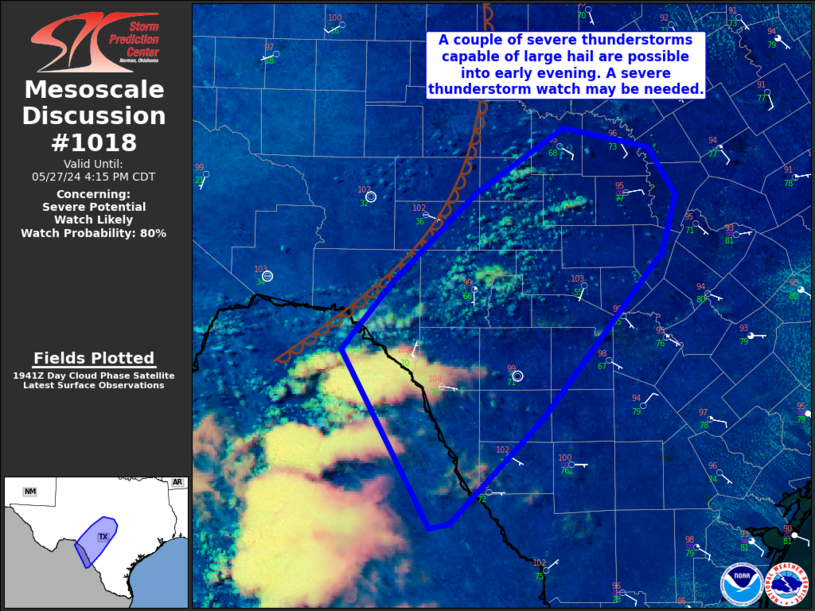
   Areas affected...portions of central TX

   Concerning...Severe potential...Watch likely

   Valid 271948Z - 272115Z

   Probability of Watch Issuance...80 percent

   SUMMARY...Isolated severe thunderstorms producing large hail and
   strong gusts will be possible into early evening.

   DISCUSSION...Strong heating to near 100 F has allowed for some
   mixing of stronger boundary-layer dewpoints over portions of the
   area. However, dewpoints generally still remain in the 60s F. Very
   steep midlevel lapse rates also are in place. This is supporting
   moderate to strong instability within a strongly sheared
   environment. Furthermore, visible satellite imagery shows
   deepening/vertically developing cumulus across the MCD area.
   Forecast soundings depict deep mixing with inverted-v low-level
   thermodynamic profiles. Given a dry EML, this may support sporadic
   severe gusts. Furthermore, elongated/straight hodographs suggest
   large hail will be possible.

   Convection has already develop across northeast Mexico and will
   approach the Rio Grande in the next few hours. This convection also
   will pose a severe risk if it is maintained across the Rio Grande
   into TX. Some uncertainty exists regarding coverage and eastward
   extent of severe potential, but at least a narrow corridor of large
   hail and strong gust potential is expected. A watch will likely be
   needed in the next hour or so.

   ..Leitman/Guyer.. 05/27/2024

   ...Please see www.spc.noaa.gov for graphic product...

   ATTN...WFO...FWD...CRP...EWX...SJT...

   LAT...LON   29420147 30000097 30770016 31349928 31179844 30769817
               30259830 28839949 27930040 27900059 28200077 29420147
|
|
|
Top/All Mesoscale Discussions/Forecast Products/Home |
|


