|
|
| Mesoscale Discussion 1015 | |
| < Previous MD | |

|
|
   Mesoscale Discussion 1015
   NWS Storm Prediction Center Norman OK
   0110 PM CDT Mon May 27 2024

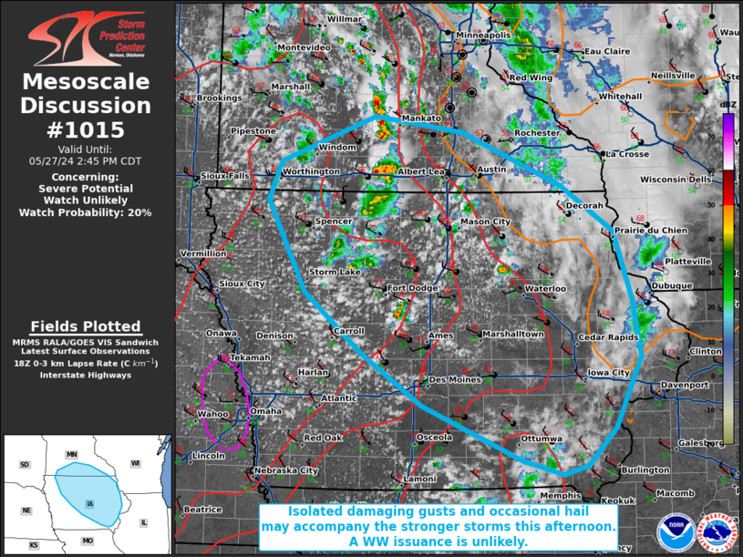
   Areas affected...portions of far southern Minnesota into
   northern...central...and eastern Iowa

   Concerning...Severe potential...Watch unlikely

   Valid 271810Z - 271945Z

   Probability of Watch Issuance...20 percent

   SUMMARY...An isolated hail and gusty wind threat will accompany the
   stronger storms through the afternoon. The severe threat should be
   isolated and a WW issuance is not expected.

   DISCUSSION...The combination of deep-layer ascent with a mid-level
   trough grazing the Upper MS Valley, and strong diurnal heating, is
   contributing to the increase in coverage and intensity of
   thunderstorms over southern MN into northern IA. These storms will
   progress southeast in an environment characterized by steep
   low-level lapse rates, which will encourage strong wind gusts
   (perhaps a couple reaching severe limits) this afternoon. Given
   elongated hodographs, the longer-lasting multicells will be capable
   of producing some hail as well. However, the overall severe threat
   is expected to remain isolated and a WW issuance is not anticipated.

   ..Squitieri/Guyer.. 05/27/2024

   ...Please see www.spc.noaa.gov for graphic product...

   ATTN...WFO...DVN...ARX...MPX...DMX...FSD...

   LAT...LON   43799556 44239431 44089316 43559182 43119114 42439090
               41889078 41189113 40809149 40729181 40869236 41399367
               41919448 42509524 43409573 43799556
|
|
|
Top/All Mesoscale Discussions/Forecast Products/Home |
|


