|
|
| Mesoscale Discussion 1014 | |
| < Previous MD Next MD > | |

|
|
Mesoscale Discussion 1014
NWS Storm Prediction Center Norman OK
1241 PM CDT Mon May 27 2024
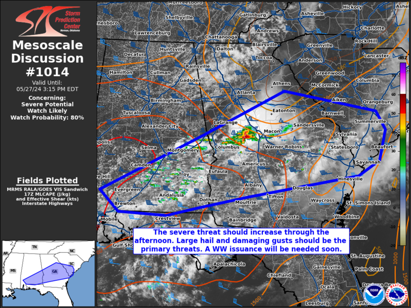
Areas affected...portions of southeast Alabama into central and
southern Georgia...southern South Carolina
Concerning...Severe potential...Watch likely
Valid 271741Z - 271915Z
Probability of Watch Issuance...80 percent
SUMMARY...The severe threat will gradually increase into the
afternoon. Large hail and damaging gusts are both a concern. A WW
issuance will be needed in the next hour or so to address the severe
threat.
DISCUSSION...In addition to an ongoing supercell over western
Georgia, thunderstorm development and intensification is underway
over eastern AL. These storms are forming within an environment
characterized by 80+ F surface temperatures and low to mid 70s F
dewpoints, yielding 2000+ J/kg MLCAPE. Strong mid-level westerly
flow is overspreading the region, contributing to 50+ kts of
effective bulk shear. As such, multicell clusters and transient
supercells should develop through the afternoon. Given steep low and
mid-level lapse rates, these storms will be accompanied by severe
hail and wind. A WW issuance will be needed in the next hour or so
to address the impending severe threat.
..Squitieri/Guyer.. 05/27/2024
...Please see www.spc.noaa.gov for graphic product...
ATTN...WFO...CHS...CAE...JAX...FFC...TAE...BMX...MOB...
LAT...LON 31478808 32828525 33858301 33358046 32908022 32188041
31848099 31378402 31108540 30928624 30988755 31478808
|
|
|
Top/All Mesoscale Discussions/Forecast Products/Home |
|