|
|
| Mesoscale Discussion 1007 | |
| < Previous MD | |

|
|
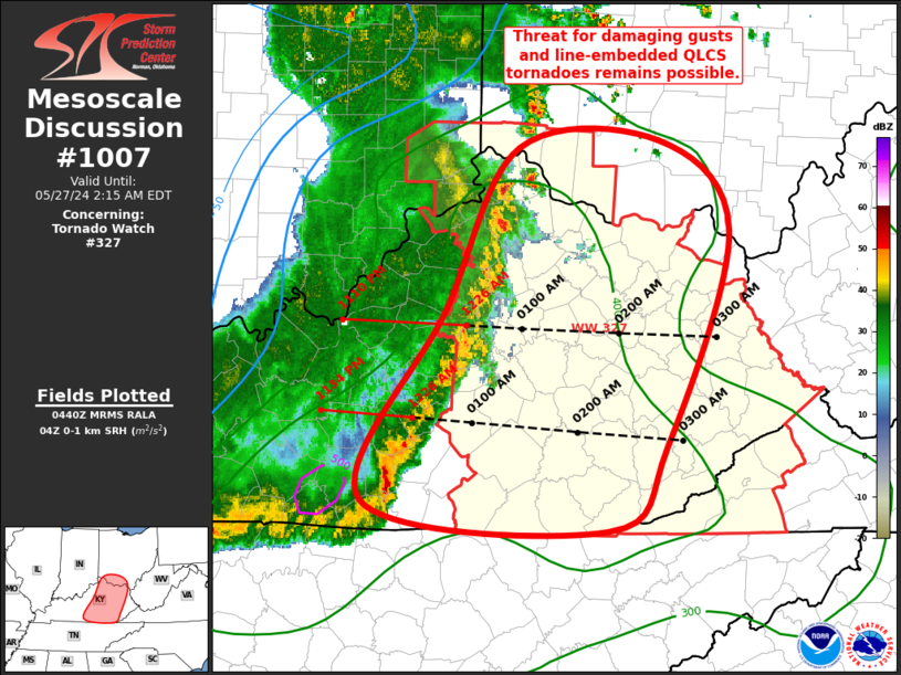
Mesoscale Discussion 1007 NWS Storm Prediction Center Norman OK 1142 PM CDT Sun May 26 2024 Areas affected...Central/Eastern KY...Far Southern OH Concerning...Tornado Watch 327... Valid 270442Z - 270615Z The severe weather threat for Tornado Watch 327 continues. SUMMARY...Threat for damaging gusts and line-embedded QLCS tornadoes remains possible. DISCUSSION...Organized convective line continues to push eastward across central KY at around 40 kt. At the this speed, the line should move into eastern KY at around 0530Z and to the edge of Tornado Watch 327 around 0730 to 0800Z. Updrafts have largely maintained their intensity over the past hour, which is a testament to the organized character of the line given the reduced buoyancy it has encountered. Vertical shear remains strong and the line is oriented favorably for continued forward propagation. Damaging wind gusts will be the primary threat within this line as it continues eastward. The JKL VAD continues to show strong low-level shear with notable veering with height, suggesting that some line-embedded QLCS tornadoes are still possible, particularly in any surge within the line. One such surge may be possible soon with the strong updraft on the southern end of the line over south-central KY. ..Mosier.. 05/27/2024 ...Please see www.spc.noaa.gov for graphic product... ATTN...WFO...RLX...JKL...ILN...LMK... LAT...LON 38058509 39148448 39188331 38588272 37178325 36608375 36808578 38058509 |
|
|
Top/All Mesoscale Discussions/Forecast Products/Home |
|


