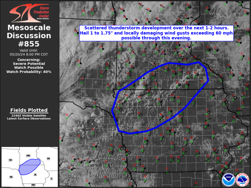
MD 0855 CONCERNING SEVERE POTENTIAL…WATCH POSSIBLE FOR NORTHWESTERN IOWA AND FAR SOUTHERN MINNESOTA
Mesoscale Discussion 0855
NWS Storm Prediction Center Norman OK
0554 PM CDT Mon May 20 2024

Areas affected...Northwestern Iowa and far southern Minnesota

Concerning...Severe potential...Watch possible

Valid 202254Z - 210100Z

Probability of Watch Issuance...40 percent

SUMMARY...Scattered thunderstorm development is likely over the next
1-2 hours across portions of northwestern/northern IA and southern
MN. Large hail up to 1 to 1.75 inches in diameter and wind gusts
exceeding 60 mph may accompany a few of the thunderstorms.

DISCUSSION...Recent satellite imagery indicates some upstream
mid-level ascent, likely via PCVA, is beginning to impact locations
east of the MO river valley over a stationary boundary. Elevated
showers have developed over northern NE, and the cumulus field along
and just north of the boundary is becoming agitated across
northwestern IA and southern MN. The convective environment within
this region is characterized by moderate instability, modest deep
layer shear, and steep mid level lapse rates. As the evening
progresses, a few organized updrafts may manage to develop with a
threat of large hail and locally damaging wind gusts. There is some
uncertainty regarding severe thunderstorm coverage across this
region, however, so trends will be watched for a possible weather
watch.

..Barnes/Thompson.. 05/20/2024

...Please see www.spc.noaa.gov for graphic product...

ATTN...WFO...ARX...MPX...DMX...FSD...OAX...

LAT...LON   42149452 42029497 41939575 42029627 42739661 43419632
            43809554 44109495 44349428 44459386 44389296 44469241
            44259207 43809196 42869309 42499374 42149452