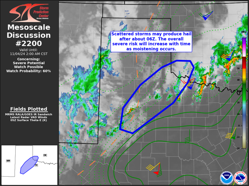
MD 2200 CONCERNING SEVERE POTENTIAL…WATCH POSSIBLE FOR PARTS OF THE SOUTH PLAINS…NORTHWEST TEXAS AND FAR SOUTHWEST OKLAHOMA
Mesoscale Discussion 2200
NWS Storm Prediction Center Norman OK
1137 PM CST Sun Nov 03 2024

Areas affected...parts of the South Plains...northwest Texas and far
southwest Oklahoma

Concerning...Severe potential...Watch possible

Valid 040537Z - 040800Z

Probability of Watch Issuance...60 percent

SUMMARY...Scattered storms are likely to form after 06Z tonight over
parts of west/northwest Texas and into southwest Oklahoma. Hail will
be the primary risk.

DISCUSSION...Height falls will persist tonight with the upper
trough, while low pressure develops over western TX and into western
OK through early morning. In response, low-level winds will increase
out of the south, resulting in a northward return of theta-e and
subsequent destabilization.

Currently, modest moistening is occurring over parts of the Permian
Basin, though GPS water vapor sensors show only minor increases in
PWAT.  However, this should evolve rapidly tonight as wind speeds
increase.  Given cool temperatures aloft, this warm/moist advection
will likely yield a zone of thunderstorms developing from the South
Plains into southwest Oklahoma late.

Initial activity may not be severe, but as moisture accelerates
northwestward overnight, severe hail is expected.  Both cold air
aloft, and lengthening hodographs with 60-70 kt deep-layer shear
will favor hail.  As such, trends will be monitored over the coming
hours for a possible watch.

..Jewell/Smith.. 11/04/2024

...Please see www.spc.noaa.gov for graphic product...

ATTN...WFO...OUN...LUB...AMA...MAF...

LAT...LON   34749902 34199929 33489990 32390162 32540214 33280203
            34120132 34750040 34989975 34969917 34749902


