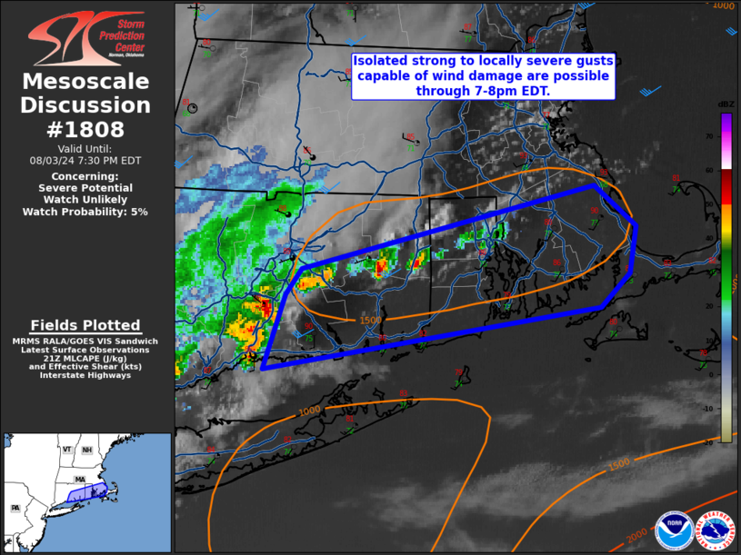
MD 1808 CONCERNING SEVERE POTENTIAL…WATCH UNLIKELY FOR EASTERN CT…RI…SOUTHEAST MA
Mesoscale Discussion 1808
NWS Storm Prediction Center Norman OK
0435 PM CDT Sat Aug 03 2024

Areas affected...eastern CT...RI...southeast MA

Concerning...Severe potential...Watch unlikely

Valid 032135Z - 032330Z

Probability of Watch Issuance...5 percent

SUMMARY...Isolated strong to locally severe gusts (50-60 mph)
capable of pockets of wind damage are possible through 8pm EDT.  The
isolated coverage of the expected wind threat will preclude a severe
thunderstorm watch issuance.

DISCUSSION...A warm/moist boundary layer is evident in late
afternoon surface observations (temperatures in the upper 80s to 90
with mid 70 deg F dewpoints) over southern New England ahead of a
small strong-severe thunderstorm cluster in southwest parts of CT.
This activity will likely move east-northeast over the next few
hours.  Short-term model forecast soundings show upwards of 2000+
J/kg MLCAPE with PW around 1.9 inches.  A couple of the stronger
thunderstorm cores may yield a localized damaging wind risk into the
evening before this activity weakens.

..Smith.. 08/03/2024

...Please see www.spc.noaa.gov for graphic product...

ATTN...WFO...BOX...OKX...

LAT...LON   41567268 41677258 42067077 41877051 41657055 41507073
            41207283 41567268


