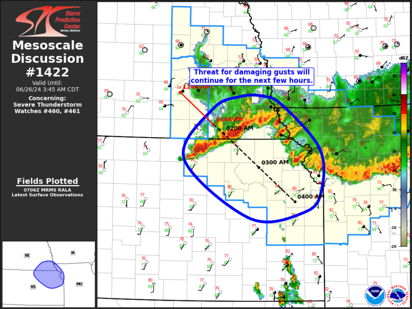
MD 1422 CONCERNING SEVERE THUNDERSTORM WATCH 460…461… FOR SOUTHEAST NE…NORTHEAST KS…FAR NORTHWEST MO
Mesoscale Discussion 1422
NWS Storm Prediction Center Norman OK
0208 AM CDT Wed Jun 26 2024

Areas affected...Southeast NE...Northeast KS...Far Northwest MO

Concerning...Severe Thunderstorm Watch 460...461...

Valid 260708Z - 260845Z

The severe weather threat for Severe Thunderstorm Watch 460, 461
continues.

SUMMARY...Threat for damaging gusts will continue across far
southeast Nebraska and northeast Kansas for the next few hours.

DISCUSSION...Convective line moving across southeast NE has shown a
notable increase in forward progression over the last hour, with
storm motion now estimated at 50 to 55 kt. Ample buoyancy exists
downstream for maintenance of this line, with recent mesoanalysis
estimating MUCAPE over 3000 J/kg. This line is also oriented nearly
perpendicular to the deep-layer vertical shear vector, suggesting
the recent increase in forward motion may persist as the line
continues southeastward into northeast KS. These factors suggest the
threat for damaging gusts will continue with the line for at least
the next few hours. BIE recently gusted to 57 kt.

Over time, this convective line will likely interact with the
slower-moving, more southward-progressing convective line (and
associated outflow) that is moving from the MO River vicinity across
northwest into central MO. How this interaction influences the
either line is uncertain, but there is some chance for initial
intensification of both lines before one becomes more dominant.

..Mosier.. 06/26/2024

...Please see www.spc.noaa.gov for graphic product...

ATTN...WFO...EAX...OAX...TOP...GID...

LAT...LON   39629792 40559724 40799658 40809604 40639557 39819467
            39049464 38649504 38539634 39629792


