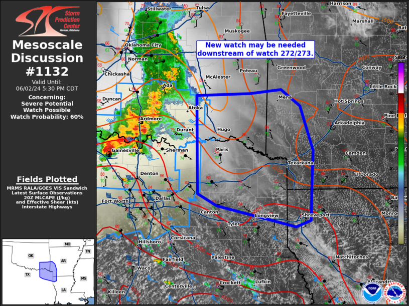
MD 1132 CONCERNING SEVERE POTENTIAL…WATCH POSSIBLE 372…373… FOR SOUTHEAST OKLAHOMA…NORTHEAST TEXAS…SOUTHWEST ARKANSAS…AND NORTHWEST LOUISIANA
Mesoscale Discussion 1132
NWS Storm Prediction Center Norman OK
0325 PM CDT Sun Jun 02 2024

Areas affected...southeast Oklahoma...northeast Texas...southwest
Arkansas...and northwest Louisiana

Concerning...Severe potential...Watch possible 372...373...

Valid 022025Z - 022230Z

Probability of Watch Issuance...60 percent

SUMMARY...A new severe thunderstorm watch may be needed downstream
of watch 272/273.

DISCUSSION...The airmass ahead of a well-established line of storms
continues to destabilize with mid-70s dewpoints and temperatures in
the mid 80s across northeast Texas. Given this strongly unstable
downstream environment (2000-3500 J/kg MLCAPE), expect this storm
cluster to continue southeast with a threat for isolated large hail
and severe wind gusts this evening.

..Bentley/Smith.. 06/02/2024

...Please see www.spc.noaa.gov for graphic product...

ATTN...WFO...LZK...SHV...TSA...FWD...OUN...

LAT...LON   34669595 34709482 34789416 34489376 33709349 33159352
            32469354 32359385 32739550 32949590 34669595