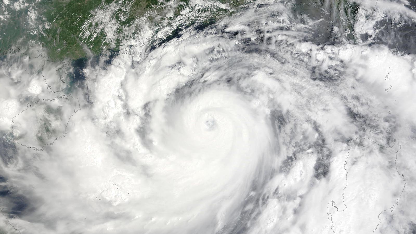
Typhoon Yagi carried out a spectacular burst of rapid intensification in the Northwest Pacific on Wednesday, bringing it from a category-1-equivalent to a dangerous category 4-equivalent in less than 12 hours. Yagi’s 1-minute sustained winds reached 150 mph at 8 p.m. EDT Wednesday, according to the Joint Typhoon Warning Center. This qualified it as a super typhoon (1-minute sustained winds of at least 15o mph), and made it the Northwest Pacific’s strongest tropical cyclone of the season thus far. Wrapped in an environment with little wind shear and ample moisture, Yagi was drawing strength from sea surface temperatures around 30-31 degrees Celsius (86-88°F), about 1-2 degrees Celsius (1.8-3.6°F) warmer than average for early September.
An eyewall replacement cycle early Thursday weakened Yagi, and at 8 a.m. EDT Thursday, the Joint Typhoon Warning Center said Yagi was a Category 4 storm with sustained 1-minute average winds of 140 mph and a central pressure of 933 mb, headed west at 10 mph. Further weakening is expected as Yagi interacts with land and as oceanic heat becomes harder to come by. Yagi is expected to make landfall on Friday morning (U.S. EDT) as a Category 3 storm in southern China’s Guangdong Province, a tropical area that includes the most southerly points on the Chinese mainland. Yagi is expected to weaken to a Cat 1 before moving into northern Vietnam by Saturday morning.
Ferries and passenger trains have been suspended between the Leizhou Peninsula and the island of Hainan, according to Xinhua. Yagi could move over or very near, Haikou, the island’s largest city (pop. 3 million), situated on the north coast of Hainan. If Yagi angles a bit further north, the mainland coastal city of Zhanjiang (pop. 7 million) could be heavily affected as well.
Should Yagi manage to reach China at Category 4 strength, it would join a select club. The lengthy, populous east coast of China has seen only 13 landfalling typhoons of at least category 4 strength in modern records (Fig. 1). Just two of those were Category 5s, most recently Rammasun in 2014. Yagi is following a path very similar to that of Rammasun, which was China’s fifth-most damaging typhoon on record (damage over $4 billion, see top-five list below). Powerful typhoons tend to either recurve before reaching China or weaken en route to the coast, especially if they interact with the mountainous landscapes of the Philippines and Taiwan.


The top five most damaging typhoons in Chinese history
According to EM-DAT, the most expensive Chinese typhoons on record (in 2023 dollars adjusted for inflation) are:
- 1) $25 billion, Doksuri, 2023
- 2) $12 billion, Lekima, 2019
- 3) $9 billion, Fitow, 2013
- 4) $6 billion, Rumbia, 2018
- 5) $4 billion, Rammasun, 2014
This list leaves out what was possibly the most destructive Chinese typhoon of all time, Typhoon Nina of 1975. Nina stalled out and dumped prodigious rains for two days in the Ru River drainage basin upstream of the Banqiao Dam, leading to the dam’s collapse and the loss of 171,000 lives, with an area 34 miles long and 8 miles wide wiped out. The disaster was not disclosed by China until the mid-1990s.
The Atlantic still peppered with only weak disturbances
Remarkably for the first week of September, the North Atlantic remains subdued when it comes to tropical cyclones. The National Hurricane Center was tracking five systems early Thursday, but none of them had probabilities of development any greater than 30 percent. This unusual situation gave the Tropical Weather Outlook issued at 8 a.m. EDT Thursday a unique (and probably unprecedented) look, with five lemon-colored threat areas, and no orange or cherry-colored ones (see Tweet below). With no strong agreement yet emerging among forecast models on any potential development over the next week, it’s not out of the question that the Atlantic will end up going four full weeks – or even a solid month – without a single new named system since Ernesto was christened on August 12.
We help millions of people understand climate change and what to do about it. Help us reach even more people like you.
Source link


