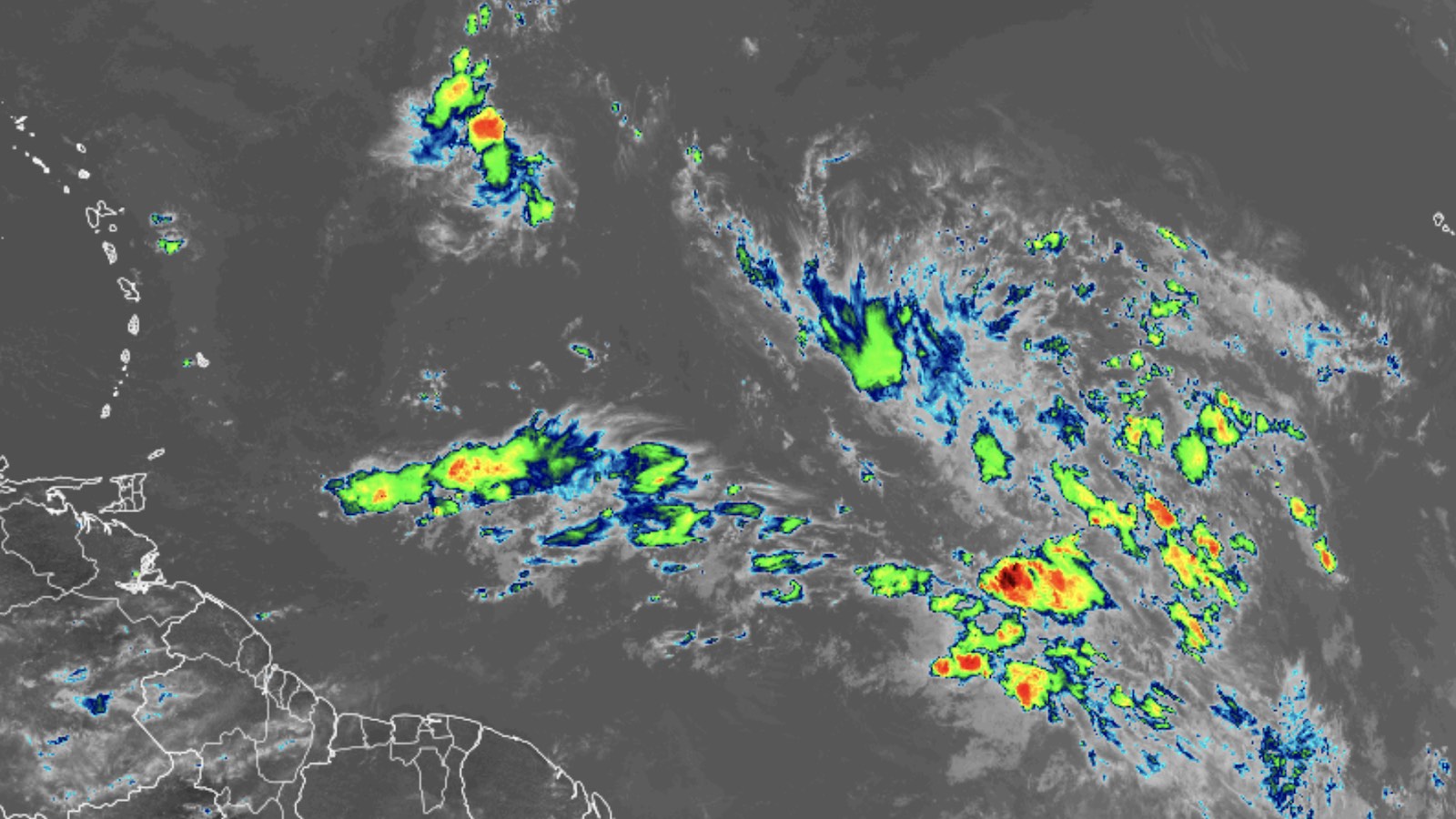
There were no tropical cyclones active anywhere in the world on Monday after the demise of Tropical Storm Sean in the Atlantic on Sunday night. This quietness is expected to end later this week, with potential threats to watch in the Atlantic, Eastern Pacific, and North Indian Ocean.
Lesser Antilles need to monitor disturbance 94L
Although the Atlantic’s Cabo Verde hurricane season is near its end, one more disturbance from Africa now traversing the tropical Atlantic could develop as it approaches the Northern Leeward Islands. Invest 94L waxed and waned over the weekend, and its large field of showers and thunderstorms, or convection, remained disorganized on Monday. However, a bit more spin was evident at lower levels.
Forecast models agree that 94L is unlikely to fully consolidate for at least a day or two, and model enthusiasm for 94L’s long-term development has dwindled. Ensemble model support is limited, and the European and UKMET operational models from Sunday night no longer developed 94L, while the GFS remained on board.
Wind shear will be increasing by late week to around 15-20 knots, and some dry air will likely infiltrate the system. Nevertheless, 94L will be passing over exceptionally warm waters for mid-October in the western tropical Atlantic (sea surface temperature of 29-30 degrees Celsius or 84-86 degrees Fahrenheit, about 1-2°C/2-4°F above average), so it bears watching until its fate becomes more clear.

In its 8 a.m. EDT Monday Tropical Weather Discussion, the National Hurricane Center gave 94L two- and seven-day odds of 30% and 70%, respectively, for developing into at least a tropical depression. A stronger storm is likely to turn to the northwest out to sea before reaching the Lesser Antilles, and a weaker storm is more likely to track farther west, potentially passing over or near the Northern Leeward Islands on Friday or Saturday before an intensifying eastern U.S. upper low likely forces the system to recurve into the open Atlantic. The next name on the Atlantic list is Tammy. The first hurricane hunter mission into 94L is scheduled for Thursday.
Another threat percolating for Mexico’s Pacific coast
After the one-two landfall punch of Tropical Storms Max and Lidia last week, another landfall may be in store for the Pacific coast of Mexico in a few days. A disturbance named Invest 90E is slowly organizing a few hundred miles south of Acapulco, Mexico, with extensive and intense convection evident on satellite. 90E is embedded in a very moist environment (midlevel relative humidity of 80-85%) and is passing over very warm sea surface temperatures of around 30 degrees Celsius (86°F), with moderate wind shear of 5-15 knots.
In its 8 a.m. EDT Monday Tropical Weather Outlook, the National Hurricane Center gave 90E two- and seven-day odds of 80% and 90%, respectively. Not all models are yet developing 90E, but those that do indicate it could reach hurricane strength by late this week. Steering currents are expected to push 90E west-northwest and then north-northwest, potentially angling toward the coast near or north of Puerto Vallarta by this weekend.
Time to watch the North Indian Ocean
The North Indian Ocean has two tropical cyclone seasons — one centered in May, before the onset of the monsoon, and one centered in October/November after the monsoon has waned. During the June-September peak of the monsoon, tropical cyclones are uncommon due to interference from the monsoon circulation.
Recent long-range forecasts from both the European and GFS models have been predicting that tropical cyclones could form by early next week in both the Bay of Bengal (to the east of India) and the Arabian Sea (to the west of India). Though the details of the timing and formation location of any such storms cannot be trusted so far in advance, interests in the North Indian Ocean should be carefully monitoring tropical cyclone outlooks over the coming 10 days, since it is probable that one or more tropical cyclones will form. The threat is greatest in the Arabian Sea, where sea surface temperatures have been boosted by an unusually strong positive mode of the Indian Ocean Dipole.

The Indian Ocean Dipole is an irregular natural oscillation of sea surface temperatures in which the western Indian Ocean becomes alternately warmer and then colder than the eastern part of the ocean. A positive Indian Ocean Dipole brings warmer-than-average sea surface temperatures to the Arabian Sea and cooler-than-average temperatures near Indonesia. The current positive Indian Ocean Dipole event has boosted temperatures in the Arabian Sea by about 1 degree Celsius (1.8°F) (Figure 2).
Read: What is El Niño?
There is no long-term trend in the Indian Ocean Dipole, and it is uncertain how climate change may affect it. Positive Indian Ocean Dipole periods often develop during the summer in conjunction with an intensifying El Niño event such as the one now in place, and in turn, a strongly positive Indian Ocean Dipole may help intensify El Niño conditions.
Website visitors can comment on “Eye on the Storm” posts (see comments policy below). Sign up to receive notices of new postings here.
Source link


