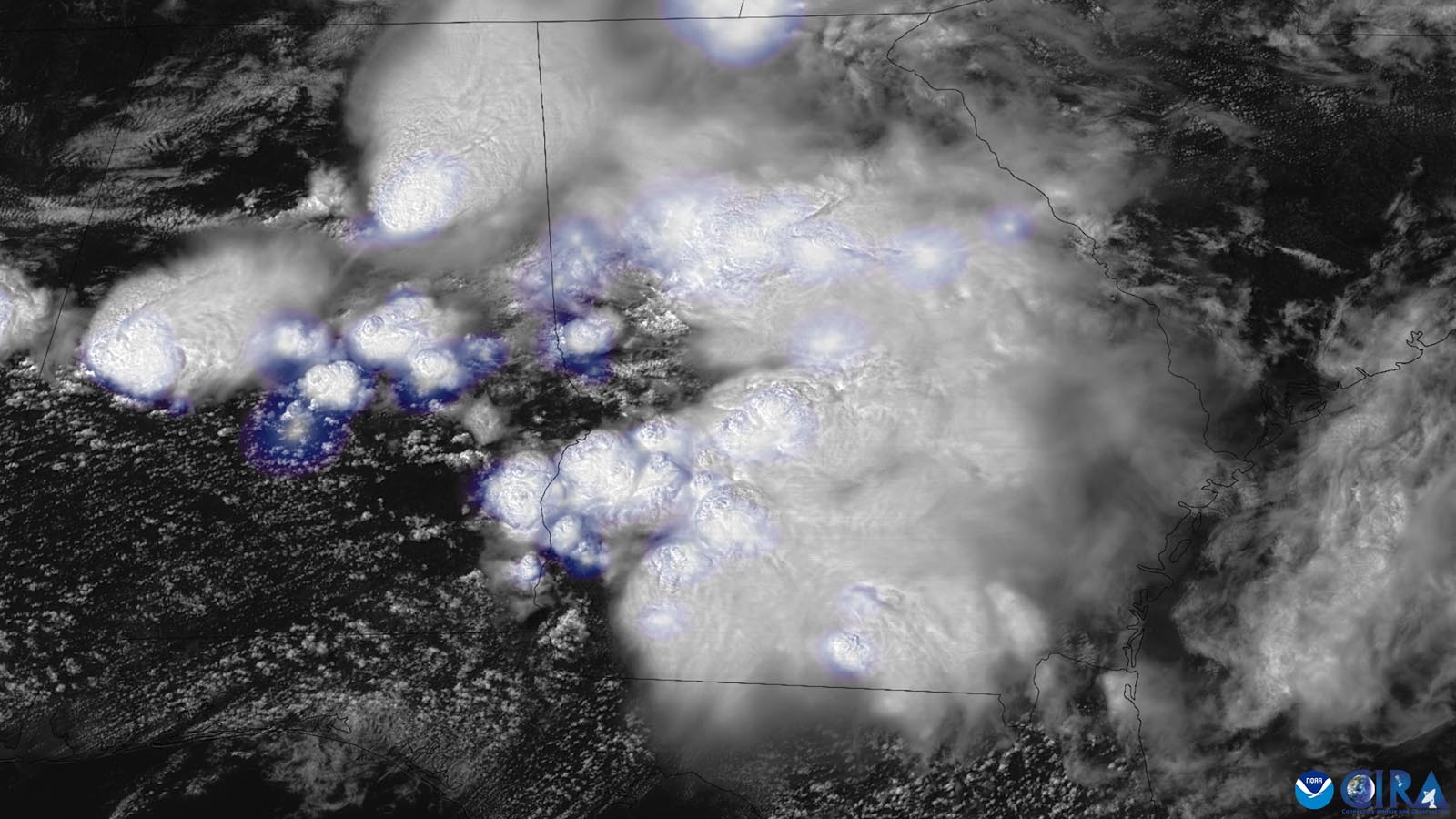
In a Deep South setup more typical of March than June, a volley of fast-moving thunderstorms ripped from Texas to Florida on Wednesday evening, June 14, downing countless trees and power lines and smashing windows. No serious injuries were reported, but as of Thursday morning, around 100,000 customers remained without power across Alabama, Florida, Georgia, Mississippi, and Texas, with nearly half that total in Alabama.
After filtering out duplicate reports, the National Weather Service/NOAA/Storm Prediction Center had tallied 223 preliminary reports of severe wind gusts (at least 58 mph) as of midmorning Thursday. These included an 82-mph gust near Kemper, Mississippi.
This event may well end up qualifying as a derecho – a long-lived, thunderstorm-driven corridor of damaging winds. The wind corridor appears large enough to qualify based on Storm Prediction Center criteria (400 miles long and 60 miles wide), as long as several gusts to at least 75 mph (another requirement) can be confirmed and provided that the characteristics observed on radar are deemed to fit the derecho prototype.
Several highly visible tornadoes were reported on Thursday, but none of them produced catastrophic damage.
The storms also pummeled the South with unusually large and widespread hail. Among the biggest preliminary reports:
2.5 inches in diameter (tennis-ball size) near Quitman, Louisiana
3.0 inches north of Hodges, Alabama
3.5 inches near Van, Texas
4 inches (softball size) near Sims, Royal, and several other locations in Arkansas, as well as Doe Run, Georgia
One stone reportedly measured a whopping 5+ inches in Brooksville, Mississippi. If confirmed, it will break the state’s long-standing hail record of 5 inches from April 1962.
Torrential rains also hammered some areas, including daily totals in Georgia of 4.40 inches in Columbus and 5.19 inches in Albany, both of which set records for any June date.
Rinse and repeat: A new round of high wind and huge hail is expected
Even as Southerners began cleaning up debris, another round of destructive thunderstorm wind loomed for Thursday, this time over the Southern Plains. The Storm Prediction Center placed the southwest half of Oklahoma under a moderate risk of severe weather, the second highest of the center’s five threat levels.
Supercell storms were expected to erupt in southwest Kansas by Thursday afternoon and race southeastward, packing wind gusts that could top 80 mph and huge, damaging hailstones. The storms are expected to pass near or over Oklahoma City, and they could affect the Dallas-Fort Worth area (where hailstorms can wreak hundreds of millions in damage) before weakening late Thursday night.
Powering the multiday outbreak is an upper-level environment more common in early spring than in mid-June. Potent impulses have been traveling through a branch of the subtropical jet stream in place across the Southern Plains and Southeast, bringing unusually cold air aloft for the season and winds exceeding 100 knots (115 mph) at cruising-altitude heights of 34,000 feet. This kind of subtropical jet stream is well known to hike the risk of severe weather during El Niño events, such as the one just declared by NOAA last week and now intensifying. However, research has found this connection to be strongest in winter, when there’s often a distinct split between polar and subtropical jet streams during El Niño.

Beneath the strong jet, a flow of very warm, moist low-level air into the U.S. from the Gulf of Mexico has been enhancing vertical wind shear and instability. Short-term forecast models early Thursday suggested that the amount of convective available potential energy, or CAPE, could reach eye-popping values of 5,000 to 6,000 joules per kilogram over the Southern Plains by afternoon. It’s rare to see air this unstable juxtaposed with substantial wind shear, as will be the case Thursday afternoon and evening.
With top-level indices like this, we can expect unusually fierce thunderstorms on Thursday, and perhaps some unusual outcomes, especially across southwest Oklahoma and northwest Texas. Tornadoes are quite possible, and one or two could be strong, but the larger-scale threat is what could be the second U.S. derecho in two days.
Derechos hinge on a finely balanced arrangement of ingredients to sustain themselves, and it can be tough to distinguish with confidence a derecho threat from a more garden-variety severe-storm setup until just a few hours before storms develop. Even so, the Storm Prediction Center flagged the possibility of a derecho in its 2 a.m. EDT Thursday outlook, and the center reiterated it in the next update, signaling the potency of Thursday’s setup.
This year in severe weather to date
This week’s multiday outbreak will likely end up as the nation’s most widespread severe weather since a rash of tornadic storms in late March and early April that led to more than 60 deaths. Of the 19 killer U.S. tornadoes of 2023 thus far, all but four occurred between March 24 and April 5, during three severe weather episodes that together produced $8.5 billion in damage, according to NOAA. The year’s most catastrophic tornado to date was the top-end EF4 on the Enhanced Fujita Scale that killed 17 people, injured 165, and destroyed much of the town of Rolling Fork, Mississippi.
All told, the preliminary total of 842 U.S. twisters through June 14 is just below the annual average to date of 906.
One recurring and distressing aspect of modern U.S. tornadoes is showing up yet again this year. Out of 65 tornado-related fatalities to date, according to the Storm Prediction Center, more than two-thirds – 44 – occurred in manufactured/mobile homes, even though less than 10% of the U.S. public lives in such homes. Even considering the higher density of manufactured homes across the South, the discrepancy is stark. As noted by geographer Stephen Strader at Villanova University:
Despite the weather and emergency management enterprises consistently suggesting that MH [mobile/manufactured home] residents evacuate their homes for sturdier shelter during tornado events, more than 50% of MH residents believe their homes are safe sheltering locations. In addition, although the U.S. Department of Housing and Urban Development (HUD) indicate that improvements in building codes in 1976 have rendered MHs as wind resistant/safe as permanent homes during tornado events, research continues to illustrate MHs are FAR LESS safe during severe wind events compared to permanent homes.
Website visitors can comment on “Eye on the Storm” posts (see comments policy below). Sign up to receive notices of new postings here.
Source link