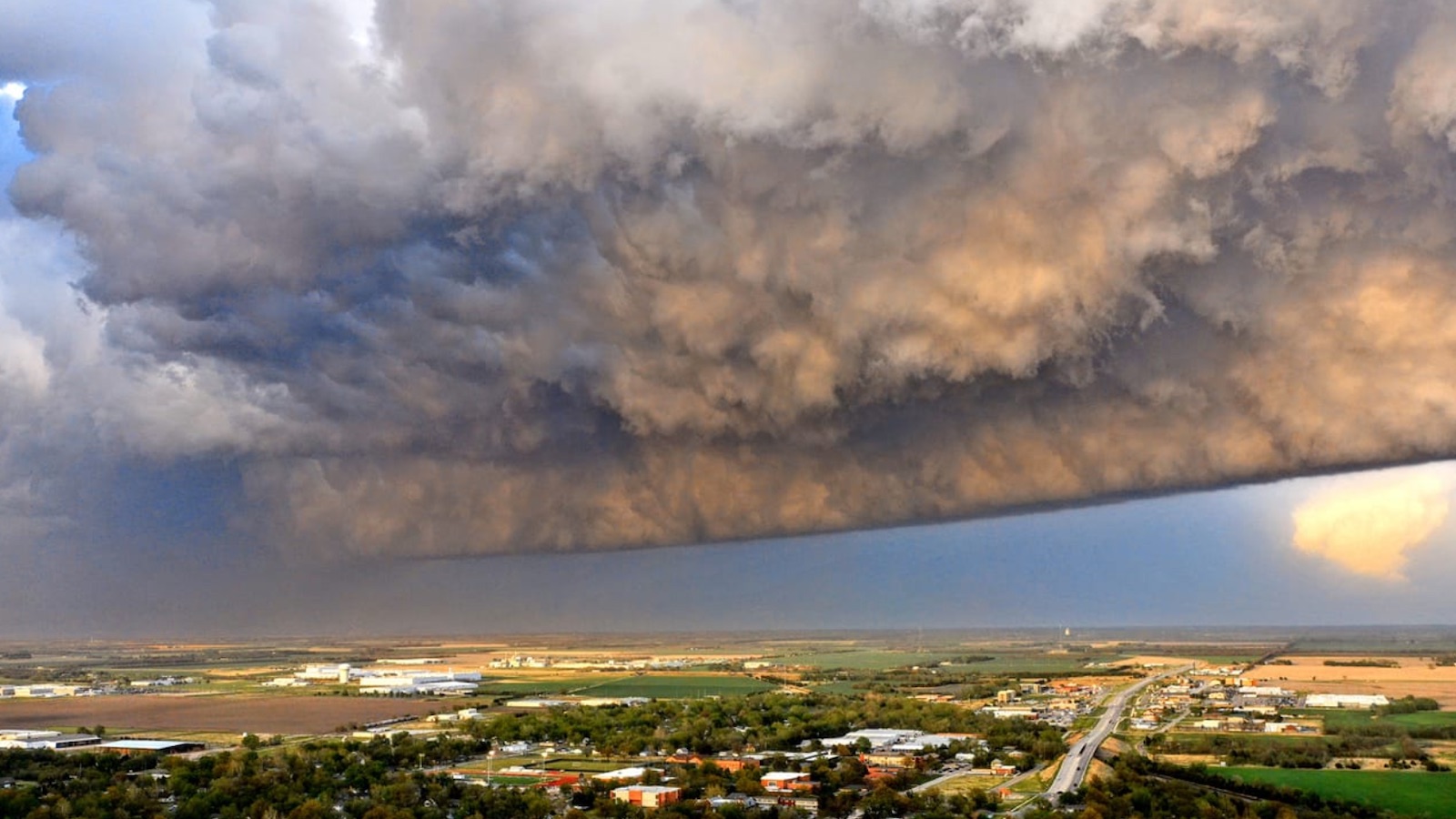
Tornado season is fast approaching its annual peak in the Southern and Central Plains, and the atmosphere during the first few days of May will be right in line with climatology. A series of upper-level impulses will traverse an oscillating frontal zone in the central U.S., and rich Gulf moisture will be streaming toward the front. The result will be several days of severe weather that could include strong tornadoes.
The NOAA Storm Prediction Center placed parts of Oklahoma, Kansas, Missouri, and Arkansas under an enhanced risk of severe weather (the third highest category) for Monday afternoon and evening. Widespread thunderstorms are expected to shift east from this area through the day, leaving behind surface wind boundaries along which new storms could form.
Provided that morning storms and clouds diminish, the compact region of most concern – with a moderate risk (the second highest level) in place – will be just ahead of a dry line, near a warm front, and south of a surging cold front. Across this part of Oklahoma and far southern Kansas, the atmosphere could become highly conducive to tornadic supercell thunderstorms for several hours late Monday afternoon. Storms may later congeal into a cluster that could produce widespread damaging wind over northeast Oklahoma. Very large hail will also be a threat.


Storms will shift into the Ohio Valley on Tuesday, with some severe weather again possible, before the next upper impulse reinvigorates the Southern Plains front, likely spawning another round of tornadic supercells on Wednesday and into Thursday.
Yet another round of Great Plains severe weather may take shape by the weekend of May 7-8 and into the next week, as the jet stream remains progressive and powerful.
A destructive tornado near Wichita spawns jaw-dropping video
The small city of Andover, Kansas – hit hard on April 26, 1991, by an F5 tornado that killed 17 people, injured more than 200, and damaged or destroyed more than 1,700 homes – was struck by another powerful twister between 8 and 8:30 p.m. CDT on Friday, April 29, 2022. Damage once again was widespread, with the Andover fire chief estimating that 300 to 400 or more buildings were destroyed. However, there were no deaths and only two serious injuries.
A storm survey led by the National Weather Service office in Wichita gave the tornado an initial rating of EF3. The estimated top winds of 165 mph are toward the lower end of the EF3 range on the Enhanced Fujita Scale.
What made this tornado especially distinctive was an unusually clear view of its tight, complex vortex, which spanned 1/4 mile at its widest. The tornadic circulation was partially detached from the parent supercell thunderstorm, as warm, dry air was entrained into the back side of the storm. The result was a distinct separation between the vortex and the storm’s precipitation, thus allowing for a rare naked-eye glimpse of details in and around a strong tornado as it lifted roofs and shredded buildings.
Video from ground-based photographers and drones showed a mesmerizing array of vertical and horizontal mini-vortexes, some lasting for just a second or two, whirling around the parent tornado. Occasionally a strong tornado will be flanked on one side by a horizontal vortex, but the multitude of circulation features in this case ranks among the most dramatic ever captured on video. It’s surely destined to spawn meteorological and engineering insights.
Three meteorology students killed on an Oklahoma highway
A tight-knit weather community was in shock this weekend after the deaths of three University of Oklahoma meteorology students as they were returning home from a storm chase on Friday night. Drake Brooks, Nic Nair, and Gavin Short were driving south on Interstate 35 just south of the Kansas-Oklahoma border when their vehicle reportedly hydroplaned, then stalled out before being struck by an semi-trailer truck.
All three were highly engaged undergraduates in the OU School of Meteorology, participating in the OU student chapter of the American Meteorological Society and serving as forecasters at the student-run Oklahoma Weather Lab (OWL).
“They were active members of my OWL shift and some of the kindest people I knew,” said Bruce Pollock on Twitter, who saw the three daily. “They not only wanted to learn from others, but also help others learn themselves. … I truly don’t know how I will walk into the lab next time, but I do know that their knowledge, kindness, and generosity will continue within the space and I will continue to pass along to others what they imparted onto me.”
My heart goes out to the families, friends, and colleagues of these three souls, who died with their futures stretching before them. Although I didn’t know any of them personally, I did spend much of my long-ago graduate school career in the OU School of Meteorology. Through personal and professional experience, I know how watching the atmosphere unfold in person can be compelling – intellectually, aesthetically, emotionally. I’m also keenly aware of the hazards it can pose: A fellow OU student, Chris Phillips, died on April 26, 1984, after swerving to avoid an animal in the road while on a storm chase.
Three well-known tornado researchers were killed in an Oklahoma storm on May 31, 2013, and highways have claimed several other chasers over the years. The circumstances of each event are starkly different, yet each one led to grief beyond measure.
Given the close-knit nature of meteorology, this weekend’s losses have resonated in universities and forecast centers across the country. Sustaining the buoyant spirits and the passion for understanding the atmosphere demonstrated by Gavin, Drake, and Nic – and maximizing the potential of that knowledge to save lives – would be fitting tributes.
A GoFundMe page has been established to help the affected families.
Jeff Masters contributed to this post. Website visitors can comment on “Eye on the Storm” posts. Comments are generally open for 30 days from date posted. Sign up to receive email announcements of new postings here. Twitter: @DrJeffMasters and @bhensonweather
Source link